?Final Price Realized includes Buyer’s Premium added to Hammer Price
Estimate: $ 1,500 - $ 2,000
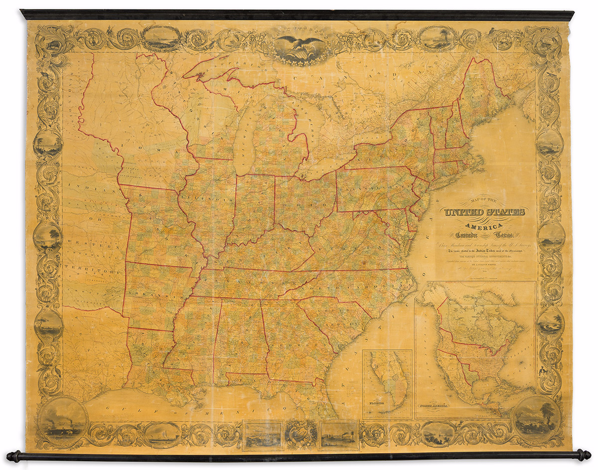
(UNITED STATES -- REPUBLIC OF TEXAS.) J. Calvin Smith; and George E. Sherman. Map of the United States of AmericaIncluding Canada and a Large Portion of Texas: Showing the Base Meridian and Township Lines of the U.S. Surveys, the Lands Allotted to the Indian Tribes West of the Mississippi, the Various Internal Improvements &c. Compiled from Surveys at the United States Land Office, and Various Other Authentic Sources. Oversize 9-sheet hand-colored wall map of the eastern United States and portions of the midwestern Territories with insets of southern Florida and North America in its entirety showing Texas as an independent Republic; the whole enclosed within a decorative foliate border interspersed with figures, scenic vignettes, important American city views, and crested by a Federal Eagle cartouche surrounded by a circle of emblematic stars representing 28 states. 66½x83 inches overall, mounted on original linen backing with black wooden rollers; varnish lightly yellowed and scuffed, minor stains at upper edge, occasional soft creases and cracks but overall a very nice example of the first edition. New York: Sherman & Smith, 1843