Jun 07, 2017 - Sale 2450

Sale 2450 - Lot 210

Price Realized: $ 4,000
?Final Price Realized includes Buyer’s Premium added to Hammer Price
Estimate: $ 2,500 - $ 3,500
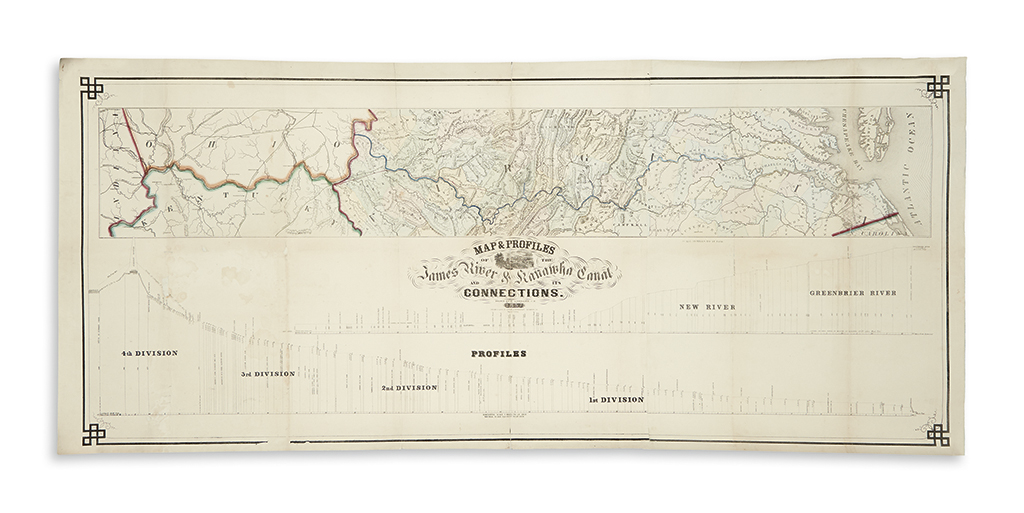
(VIRGINIA.) Lorraine, E. Map & Profiles of the James River & Kanawha Canal and its Connections. Large hand-colored lithographed map and profile scale of the Canal extending from Richmond to the Ohio River on two sheets joined. 26 1/2x61 inches overall size; original hand-color; archivally backed on thin tissue stabilizing original folds, light dampstaining with a small loss in the left quadrant. Richmond, VA: Ritchie & Dunnavant, 1857

Additional Details

The canal route follows the east flowing James and Jackson Rivers to the Allegheny Mountains where it passes through a nine mile tunnel and continues westward along the Greenbrier, New and Kanawha Rivers to the Ohio. As depicted in the profiles, the canal is divided into four divisions each containing a system of numbered locks, of which only the first two divisions from Richmond to Buchanan were ever completed and made operational. Additional features such as the Covington (James River) & Kanawha Turnpike, numerous railroad lines, localities of coal and springs, etc. are also shown. Only a handful of institutional copies are known. Stephenson and McKee, Virginia in Maps 111-18.