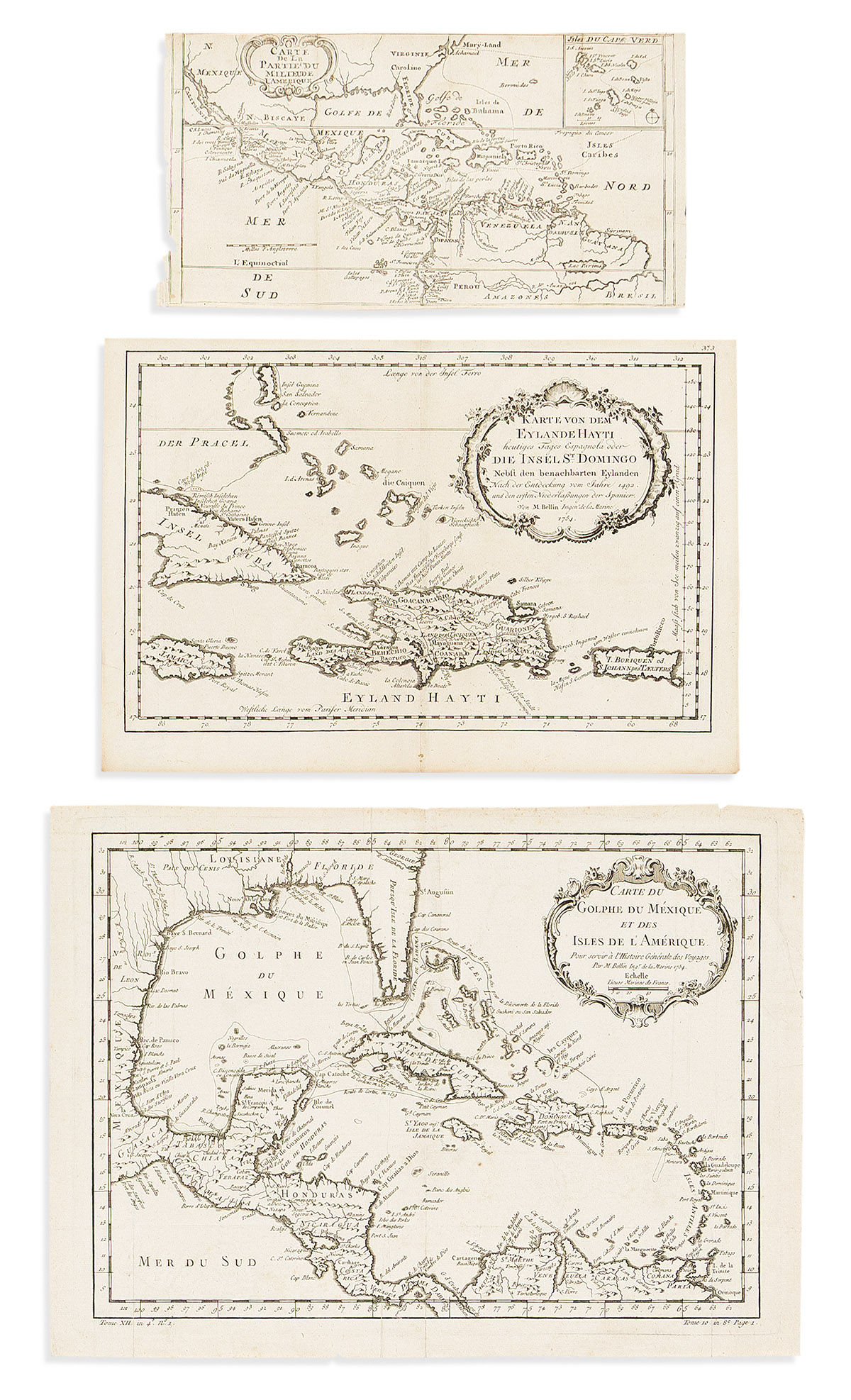
- After William Dampier. Carte de la Partie du Milieu de l'Amerique. Engraved folding map of the Central America and Caribbean region from a French edition of Dampier's Voyages. 6x11½ inches sheet size, narrow margins; rough edge at right where removed from binding. Amsterdam, circa 1750.
- After Jacques Nicolas Bellin. Karte von dem Eylande Hayti Heutiges Tages Espagnola Oder Die Insel St. Domingo. Double-page engraved map of the Bahamas, Cuba, Jamaica, Hispaniola, and Puerto Rico from the Dutch edition of Bellin's Histoire. 9½x14 inches sheet size, wide margins; minor wear only. Amsterdam, circa 1770.
- Jacques Nicolas Bellin. Carte du Golphe du Mexique et des Isles de l'Amerique. Engraved folding map of Florida, the Gulf of Mexico, Central America, and the Caribbean. 12¼x16¾ inches sheet size, wide margins; minor creases. Paris, 1754.
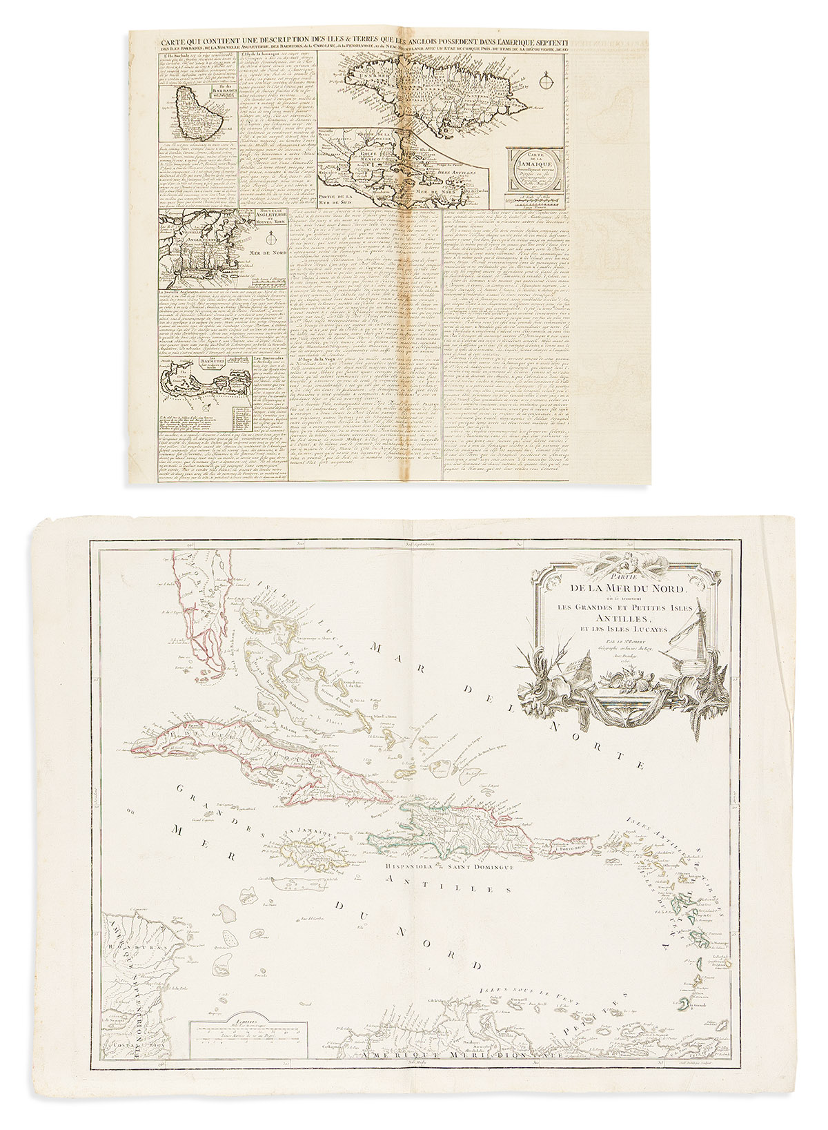
- Henri Chatelain. Carte qui Contient une Description des Iles & Terres que les Anglois Possedent dans l'Amerique Septentrionale. Engraved folding sheet of descriptive text with inset maps of the West Indies, Jamaica, Barbados, New England, Bermuda, the Carolinas, the Chesapeake, and eastern Canada. 16½x22 inches sheet size, ample margins; binding adhesive discoloration at center fold. Amsterdam, circa 1719.
- Gilles and Didier Robert de Vaugondy. Partie de la Mer du Nord, ou se Trouvent les Grandes et Petites Isles Antilles, et les Isles Lucayes. Double-page engraved map of the Caribbean. 21x27½ inches sheet size, wide margins; original hand-color in outline; minor creases. Paris, 1750.