(WISCONSIN.) Surveyor General's Office; Lucius Lyon, Micajah. T. Williams, et. al. Album of Lafayette County township survey plats. 20 manuscript survey maps on partly-printed prepared linen templates interleaved with album sheets of ruled "Scotch Linen Ledger" paper, official manuscript certification statement by C.F. Fricke, chief clerk Wisconsin Commission of Public Lands, with their gilt embossed stamp bound in. Folio, 16x15 1/2 inches, polished calf over reversed sheep with gilt title label to upper cover, worn, spine perished; maps generally fine with only minor signs of age. Wisconsin, early 1830s
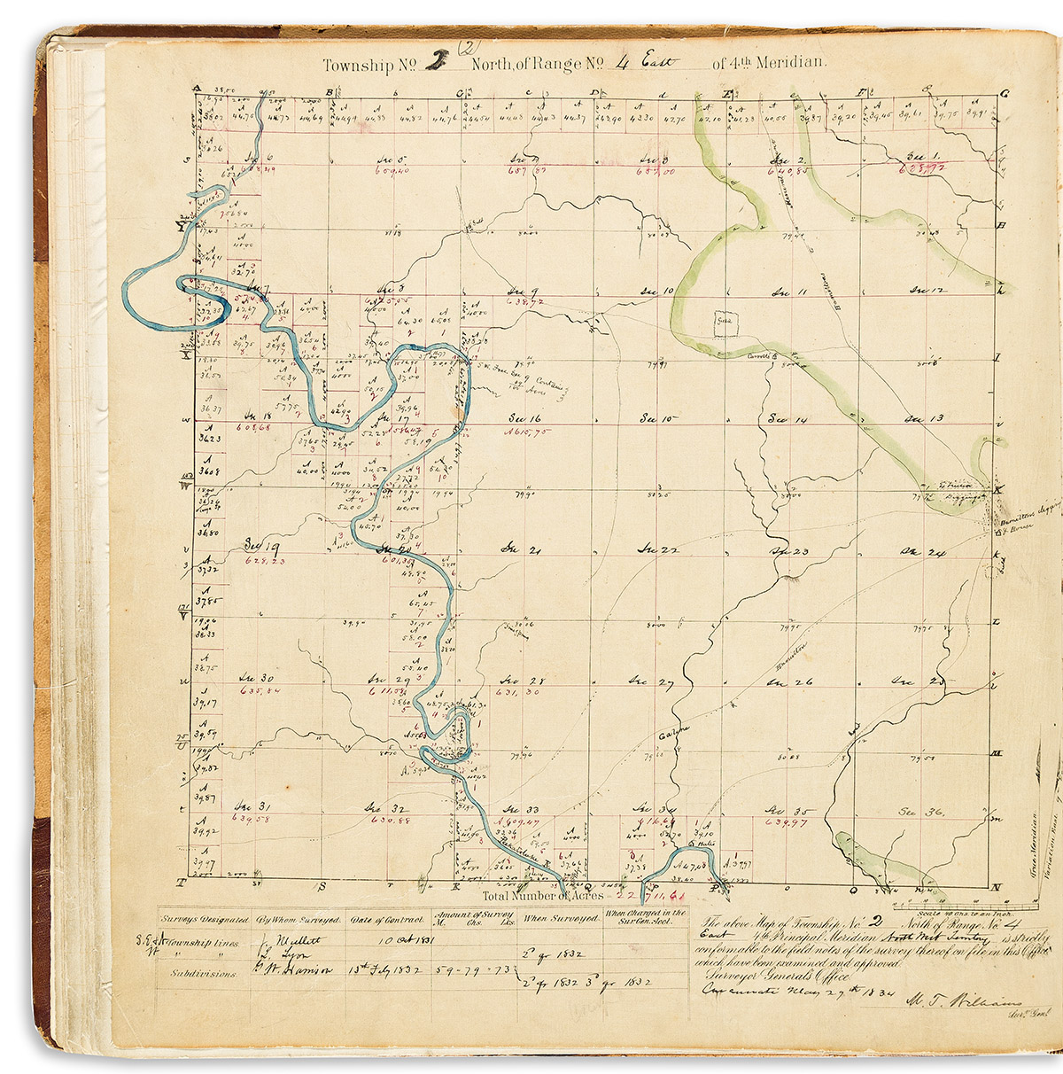
In 1833 when Lucius Lyon surveyed these lands in present-day southwestern Wisconsin, the area was still part of the Michigan Territory. In 1836 Wisconsin was chartered as its own territory and ultimately granted statehood in 1848.
During this time the region experienced a great influx of settlement and demand for land. The American government, in the form of the Public Land Survey System, systematically divided and platted hundreds of thousands of square miles for these purposes.
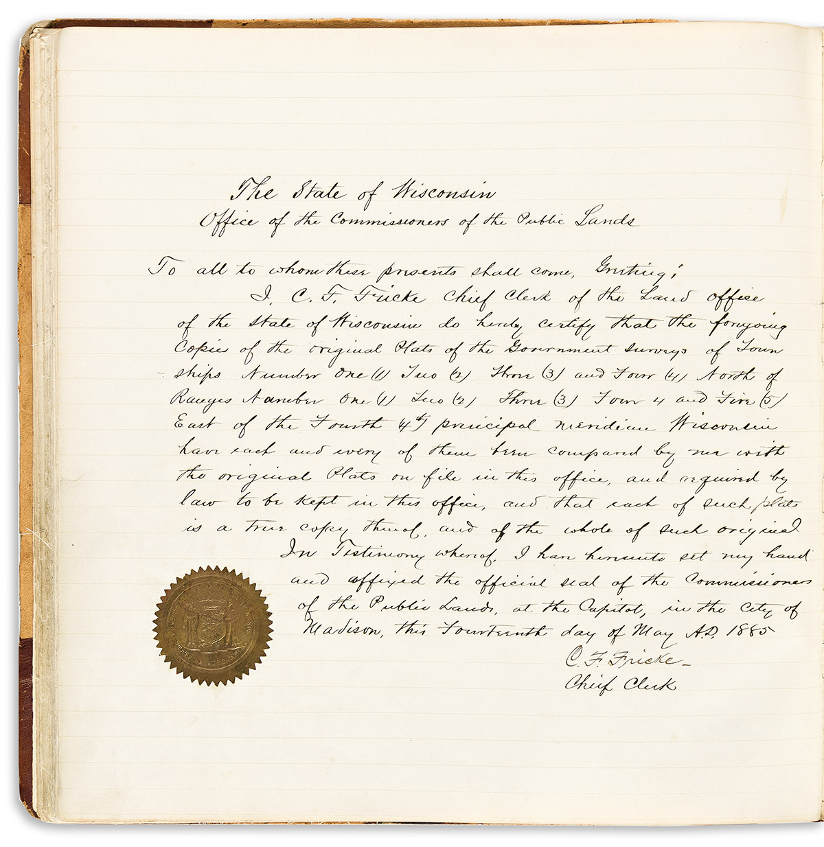
The present group of 20 manuscript plats were surveyed in southwestern Wisconsin from 1832-1833 by Lucius Lyon and officially recognized by Surveyor General Micajah T. Williams in Cincinnati in 1834. The archive was rebound in 1885 along with the manuscript declaration of C.F. Fricke of the Wisconsin Commission of Public Lands.