?Final Price Realized includes Buyer’s Premium added to Hammer Price
Estimate: $ 3,000 - $ 4,000
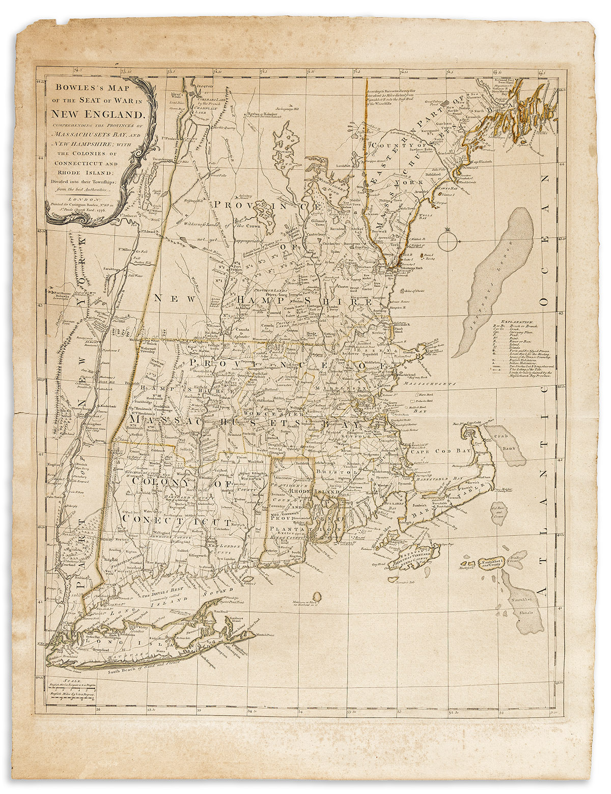
(NEW ENGLAND.) Carington Bowles. Bowles's Map of the Seat of War in New England,Comprehending the Provinces of Massachusets Bay, and New Hampshire; with the Colonies of Connecticut and Rhode Island; Divided Into Their Townships. Double-page engraved Revolutionary War-period map of New England. 29 1/2x22 1/2 inches sheet size, wide margins; strong original hand-color in outline; light foxing, toning, and minor edge wear. Stevens & Tree 32(c) (but here without the inset of Boston Harbor); McCorkle 765.1 and 776.8. London, 1776