?Final Price Realized includes Buyer’s Premium added to Hammer Price
Estimate: $ 25,000 - $ 35,000
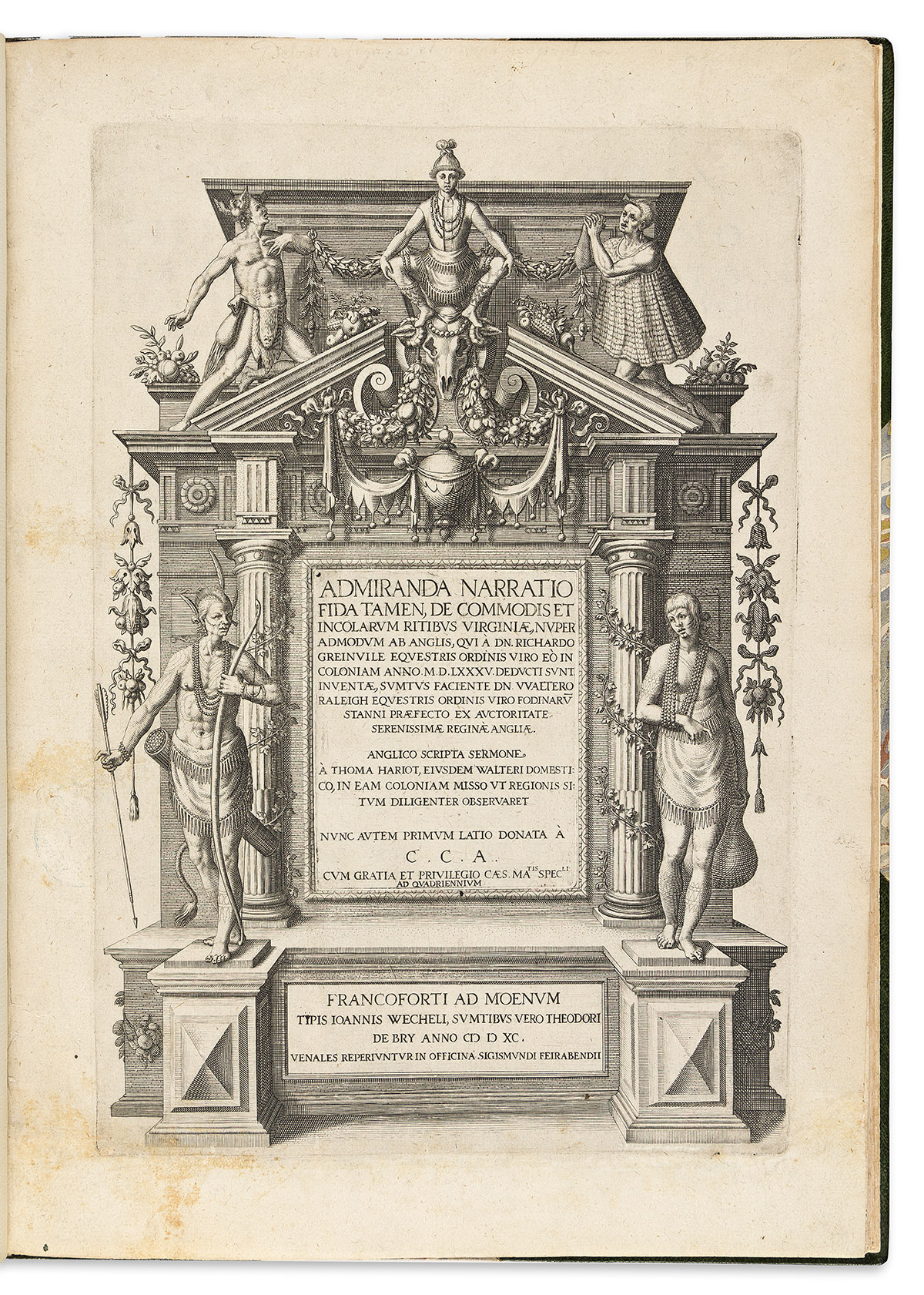
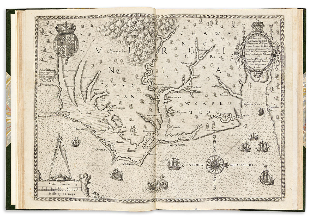
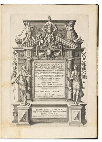
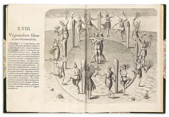
(VIRGINIA.) Thomas Hariot. Admiranda narratio fida tamen, de commodis et incolarum ritibus Virginiae (Part One of DeBry's Great Voyages in Latin). Complete with 64 leaves including 31 illustrations as follows: 34 pages (including engraved title and engraved page 3), [3] preliminary text leaves, plate, folding map [plate I], plates numbered II to XXIII with text (16 of them on one leaf with descriptive text, 2 of them folding with descriptive text, and 4 with separate facing text leaves), [5] additional plates with facing text leaves, [7] pages including colophon. Folio, 13 x 9½ inches, early 20th century ½ green morocco over marbled paper by Sangorski & Sutcliffe, minimal wear; tape remnants on front endpapers, intermittent minor dampstaining and wear, a few leaves mounted on stubs, lacking blank leaf D6. Frankfurt: Theodore De Bry, 1590
First edition, mostly second issue, of the first of De Bry's series of great and small voyages. It includes the first map of Virginia and numerous engravings of Native American life.
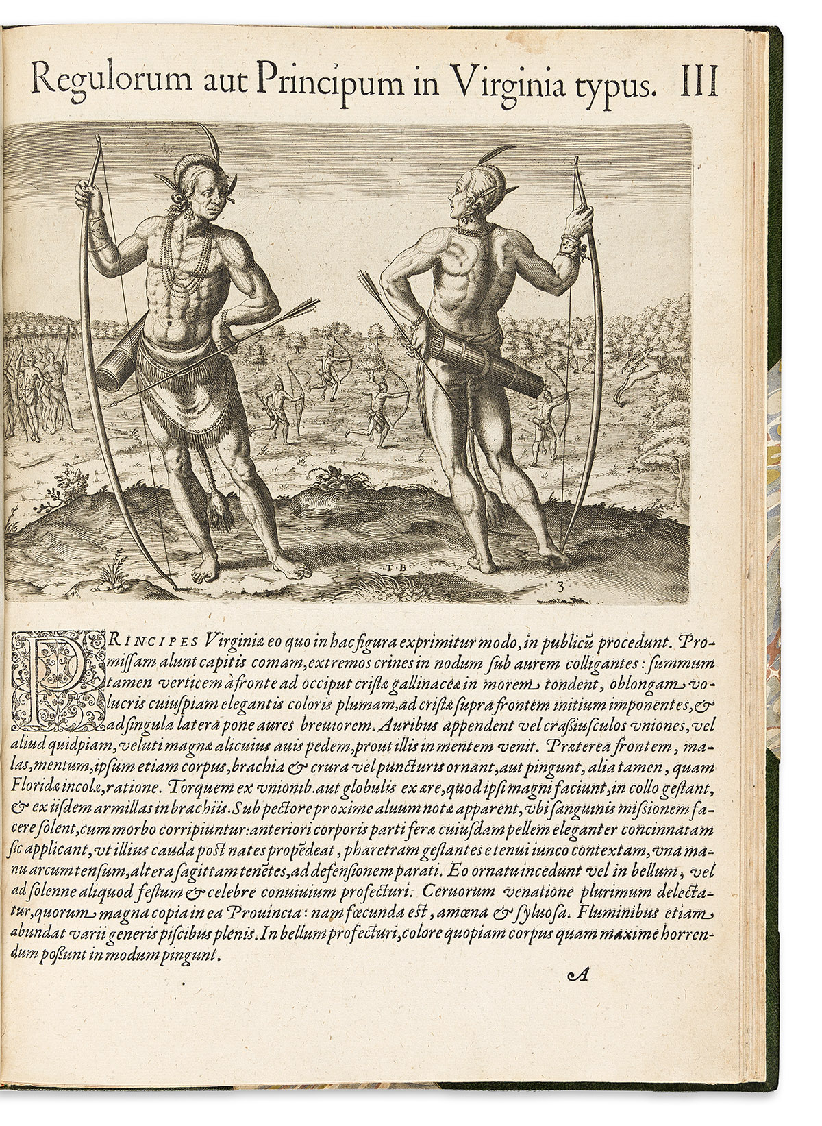
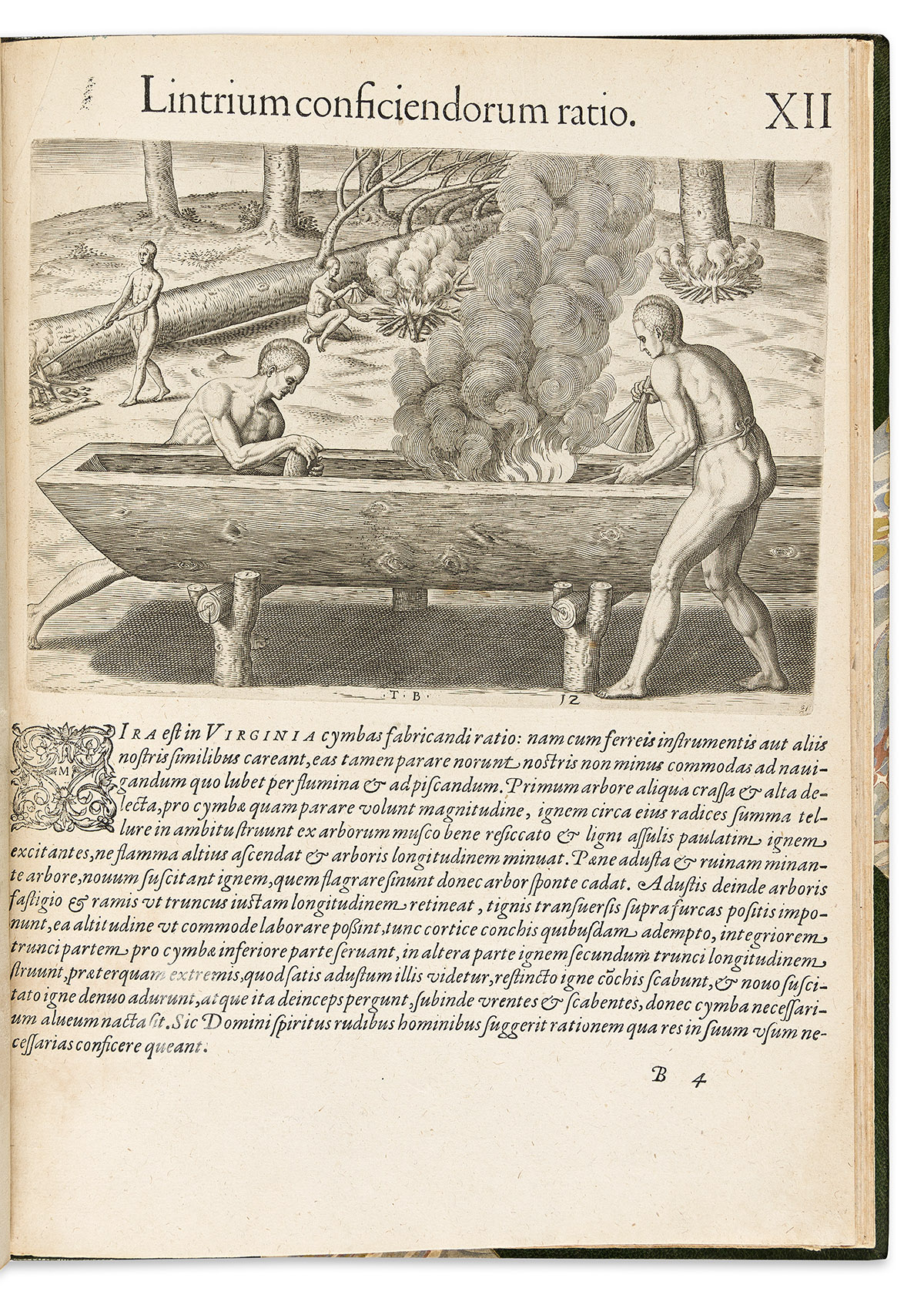
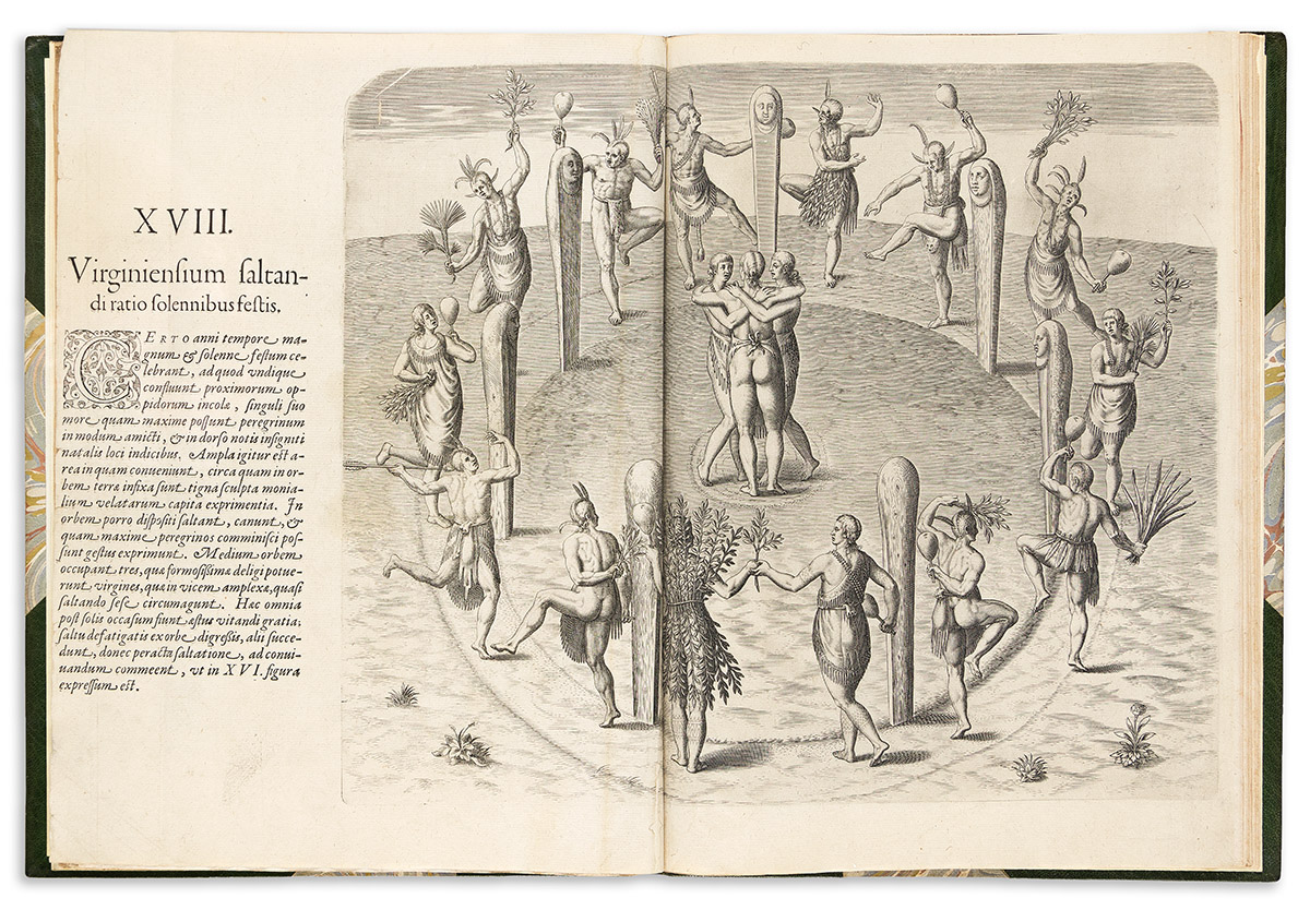
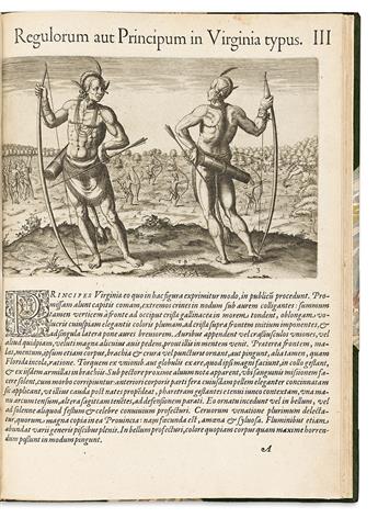
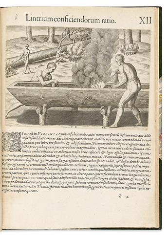
The scientist and linguist Thomas Hariot accompanied Walter Raleigh to the Roanoke colony in 1585. Returning to London, he published "A Briefe and True Report of the New Found Land of Virginia" in 1588; it is unobtainable today. In 1590, Theodore De Bry published Hariot's work in English, Latin, German, and French editions as the first installment of his long-running Great Voyages series. The text is enhanced by numerous dramatic engravings, mostly after watercolors by Hariot's fellow colonist John White.
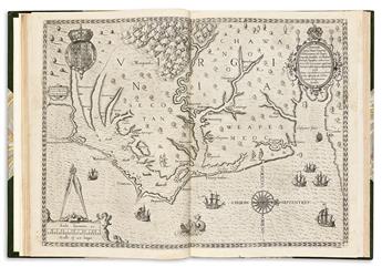
The double-page map, "Americae pars, Nunc Virginia," shows the coastal region from the Chesapeake Bay down to North Carolina's Outer Banks. To embellish the scene, 4 canoes are shown paddling about the Pamlico Sound, 3 American Indians stand upon the shore, and several English vessels are shown in the ocean. "One of the most significant cartographical milestones in colonial North American history. It was the most accurate map drawn in the sixteenth century of any part of that continent. . . . This is the first map to focus on Virginia (now largely North Carolina), and records the first English attempts at colonisation in the New World" (Burden 76). This is the second state of the map, with the name of one village crudely corrected from Ehesepiooc to Chesepiooc with the original "E" still visible underneath (Cumming 12). It is, of course, an early spelling of Chesapeake--the first appearance of the name in print.
This example follows all points for the first edition, second issue as described in Crawford, with these exceptions: page 29 is the first issue, with line 7 ending "nuncu-"; the Adam and Eve plate preceding the numbered plates is a second edition with the credit reading "Io. Theodore de Bry"; Plate IX is the first issue; Plate XXIII is incorrectly signed D4 as described in Church, rather than D; and the errata page is the second edition. See Ludovic, Earl of Crawford, "Bibliotheca Lindesiana: Grands et Petits Voyages of de Bry," pages 105-109; Church 140-141; European Americana 590/31. Further collation notes upon request.