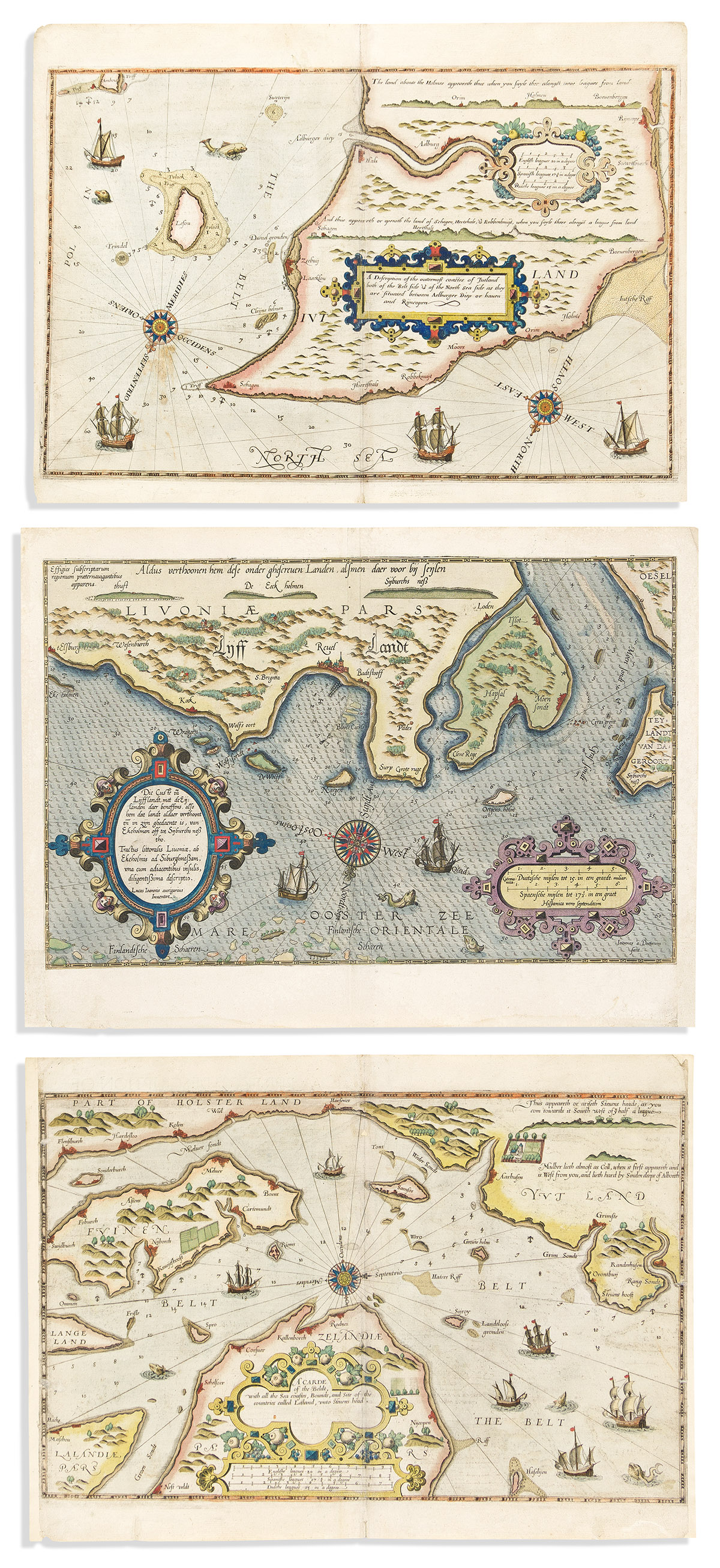
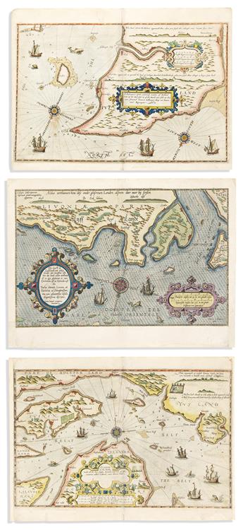
(Insular Denmark - Kalundborg.) A Carde of the Beldt with all the Sea Coastes, Bounds, and Site of the Countries Called Laland, unto Stevens Head. 15 1/2x21 1/4 inches sheet size; old hand-color; right and left margins replaced; English text on verso.
(Northern Denmark - Skagen, Laeso Island.) A Description of the Outtermost Coastes of Jutland both of the Belt Side & of the North Sea Side as they are Situated Between Aelburger Diep or Haven and Rijncopen. 15 1/2x21 inches sheet size; old hand-color; only minor wear; English text on verso.
(Insular Denmark - Kalundborg.) Mappa Fluminis dicti vulgo Beldt, cum Omnibus Littoralibus oris, Limitibus, Situque Terrarum vulgo Dictarum Lalandiae. 15 1/2x23 inches sheet size; old hand-color with touches of gold; re-margined and lined on verso; Dutch text on verso.
(Northwest coast of Estonia - Tallinn [Reuel].) 16x21 1/2 inches sheet size; old hand-color; repairs to lower left and right margins; Latin text on verso.