May 26, 2016 - Sale 2417

Sale 2417 - Lot 5

Price Realized: $ 37,500
?Final Price Realized includes Buyer’s Premium added to Hammer Price
Estimate: $ 10,000 - $ 15,000
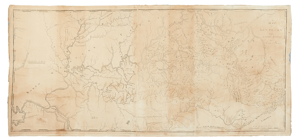
BARKER, ELIHU; and CAREY, MATHEW. A Map of Kentucky from Actual Survey By Elihu Barker. Large engraved wall map on two joined sheets. 17 1/2x39 inches plate size, small margins; light even toning, possibly washed, backed with archival tissue. Philad[elphi]a: Engraved for & sold by Mathew Carey, [circa 1794]

Additional Details

A storied rarity in the mapping of frontier America. Barker's impressive production belongs in the exclusive group of large format American state maps that were published in the young nation prior to 1800. Although the mapping is widely known through Carey's reference to it in his much smaller Kentucky map of 1795, the original Barker has not been seen on the market since 1922. In that sale, Anderson Galleries cataloged it thusly: "Excessively rare… Ranking, in historical importance and interest, next to the Filson Map."
The sentiment is echoed by Clark in Historic Maps of Kentucky, (cf. number 3, pages 68-70): "Elihu Barker's map of Kentucky is the most important one produced in the eighteenth century, John Filson's notwithstanding. It was prepared sometime before 1793, possibly early in 1792, and presents the new state at the time of its admission to the Union."

"Special attention should be directed to this particular map… Undoubtedly it is a rare item and deserves wider recognition by collectors than it has had in the past. The writer knows of but one copy, which is the one in the Rochambeau Collection [Library of Congress] now being described." - Jillson, "Early Kentucky Maps" in The Register of the Kentucky Historical Society.

The map is also noteworthy as an early cartographic publication from Carey, predating his earliest atlas, and marking the beginning of an era that would see him become the most important map and atlas publisher in America.