Dec 05, 2017 - Sale 2464

Sale 2464 - Lot 16

Price Realized: $ 17,500
?Final Price Realized includes Buyer’s Premium added to Hammer Price
Estimate: $ 15,000 - $ 20,000
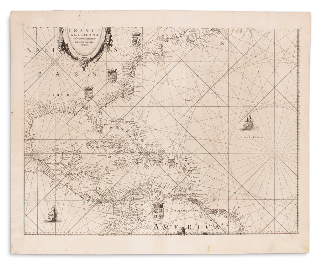
BLAEU, WILLEM. Insulae Americanae in Oceano Septentrionalis, Cum Terris Adjacentibus. Double-page engraved chart of the Americas with a separately printed title pasted on the upper cartouche. 19x23 1/2 inches sheet size, wide margins, German text on verso; strengthening to margin only of lower centerfold, small worm hole to the very edge of left and right margins, else quite fine. Amsterdam, 1634

Additional Details

Though issued as part of an atlas, the present chart is actually just a portion of a much larger work of the entire Atlantic Ocean. Willem Janszoon Blaeu published his oversized West Indische Paskaert in 1630. That chart was seemingly intended for the sole use of the Dutch East India Company to aid in their colonial enterprises in the New World and is surmised it was never offered for general sale. As such it is only known to exist in two complete copies.

In 1634, Blaeu was under pressure to meet the advertised date for release of the German edition of his Atlas Novus but several maps, including that of the West Indies, were unfinished. Rather than delay publication, Blaeu resorted to a creative shortcut: he masked off the upper left section of the plate for the West Indische Paskaert, printing only an atlas sized portion of the Caribbean and North America. A printed paper slip bearing the new title was pasted to the blank cartouche and his problem was cleverly worked out. The 1634 German edition is the only atlas to include this version of the chart, as the new engraved plate was prepared by the following year. There are fewer than ten known examples of this wonderful chart with a curious printing history, several of which still remain in atlas format. Burden 233, state 1a; Tony Campbell, "One Map Two Purposes," The Map Collector, 30 (1985.)