Dec 08, 2005 - Sale 2060

Sale 2060 - Lot 57

Price Realized: $ 4,140
?Final Price Realized includes Buyer’s Premium added to Hammer Price
Estimate: $ 1,200 - $ 1,800
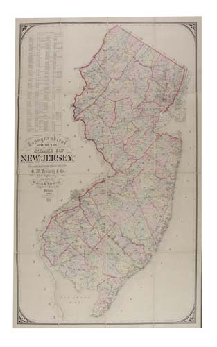
BROMLEY, G. W. & Co. Topographical Map of the State of New Jersey. Hand-colored lithographed case map in 16 sections, 1720x1120 mm overall; linen-backed; attached to and folding into the original cloth case (465x315mm), case has been neatly rebacked. Philadelphia, 1884

Additional Details


Pasted on the inside of the front cover there is a small paper label of B. S. Demarest, Maps and Map Mounting, 36 Vesey St. N.Y. The same paper label is pasted on the map itself below the Scale of Miles at the bottom of the map's title. Ristow, page 260, mentions G. W. Bromley as a principal publisher of real estate atlases located in Philadelphia and later in New York City. Rumsey and LOC list a number of New York City, Westchester County (NY) and surrounding area atlases published by G. W. Bromley from 1879 to 1893. Therefore, there is a possibility that although this map was printed and published in Philadelphia it was dissected and laid on linen in New York City where Bromley had an office. B. S. Demarest would be Bromley's subcontractor in such a case. A truly rare case map and found in no institutional collections.