Dec 08, 2005 - Sale 2060

Sale 2060 - Lot 13

Price Realized: $ 29,900
?Final Price Realized includes Buyer’s Premium added to Hammer Price
Estimate: $ 7,000 - $ 10,000
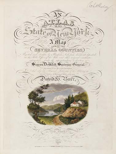
BURR, DAVID H. An Atlas of the State of New York. Beautiful engraved title with hand-colored vignette view of the Hudson near Fishkill, 52 hand-colored maps, including 2-sheet map of Manahttan (numbered 2 and 3). Folio, 570x455 mm, modern 1/2 calf over contemporary marbled boards. Ithaca, 1840

Additional Details


Unrecorded variant. David Burr's atlas and his corresponding large-format wall map of New York State were sponsored by the New York Legislature and prepared under the auspices of the State Surveyor General - Simeon DeWitt. It was Burr's greatest project and took about 3 years to complete. This copy appears to be an intermediate state between the Second Edition of 1839 and the Third Edition of 1841. There are a number of differences between this variant and the editions issued just before and after. Most differences lie in the dates on the maps and the combinations of those maps as they appear in the atlas. Like Rumsey 105 it is dated 1840 on the title page, the large folding map of Manhattan has imprint "Third Edition 1840" and there is no page 41 with additional statistics from the 1840 census (present in the 1841 edition), However, like in the 1841 edition (Rumsey 106) the copy here has the general map of New York State dated 1841. More importantly, while Rumsey 105 has 14 maps dated 1839 ("Republished ... 1839"), the rest dated 1840, in this later copy there are only 4 maps dated 1839, one dated 1841, the rest dated 1840. Rumsey 105 and 106.