Dec 09, 2004 - Sale 2027

Sale 2027 - Lot 84

Price Realized: $ 25,300
?Final Price Realized includes Buyer’s Premium added to Hammer Price
Estimate: $ 10,000 - $ 15,000
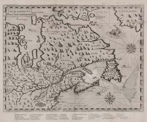
CHAMPLAIN, SAMUEL de. Carte geographique de la Nouelle franse en son vray meridiein. Engraved folding map, 250x335 mm plate size (300x370 mm sheet size), wide margins; very small hole (3x10 mm) between latitude marks 61 and 62 along the right side nicely replaced in manuscript facsimile, minor thinning along the centerfold (only visible when held to light). Nice dark impression. Paris, 1613

Additional Details


The second state, with a sea monster replacing the ship in the Davis Strait (possibly indicating whaling grounds), the Ottawa River shown for the first time, an imprint added below the scale and a new key below the map. "Both states of the map are a combination of Hudson's discoveries in the north . . . and Champlain's own explorations further south. As such, the maps provide a good interpretation of the geography of the whole of Eastern Canada"--Kershaw I:62; Burden 161.