Dec 09, 2004 - Sale 2027

Sale 2027 - Lot 81

Price Realized: $ 1,495
?Final Price Realized includes Buyer’s Premium added to Hammer Price
Estimate: $ 1,000 - $ 1,500
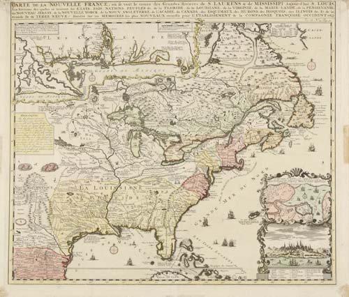
CHATELAIN, HENRI. Carte de la Nouvelle France, ou se voit le cours des Grandes Rivieres de S. Laurens & de Mississipi. Double-page engraved map, 420x490 mm, trimmed close along top margin but ample, others wide; hand-colored; minor cellotape staining in margins (easily matted out). Amsterdam, 1719

Additional Details


A nice copy of the first state of this map, published in Chatelain's Atlas Historique. It is a one-sheet version of De Fer's important 4-sheet depiction of the region from the year prior. The map includes inset maps of the mouth of the Mississippi and Quebec, as well as a view of Quebec. Kershaw II:332; McCorkle 719.4