Jun 14, 2007 - Sale 2118

Sale 2118 - Lot 45

Price Realized: $ 1,920
?Final Price Realized includes Buyer’s Premium added to Hammer Price
Estimate: $ 2,000 - $ 3,000
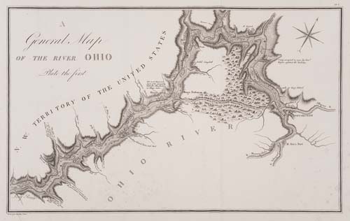
COLLOT, G. H. V. A General Map of the River Ohio. Plate the First. Engraved folding map, 300x485 mm, wide margins; very short tear neatly closed in lower margin, minor spotting in lower quadrants, few pin-size holes from worming; matted. Paris, 1826

Additional Details

Collot descended and mapped the Ohio and the Mississippi in 1796, but his manuscript charts were not engraved until 1804. By that time, publication of his atlas was suppressed due to the Louisiana Purchase and the maps not published until 1826, when it was issued in a very limited edition. This first chart of his map of the Ohio depicts from the headwaters to Pittsburgh.