Dec 08, 2005 - Sale 2060

Sale 2060 - Lot 138

Price Realized: $ 3,450
?Final Price Realized includes Buyer’s Premium added to Hammer Price
Estimate: $ 3,000 - $ 4,000
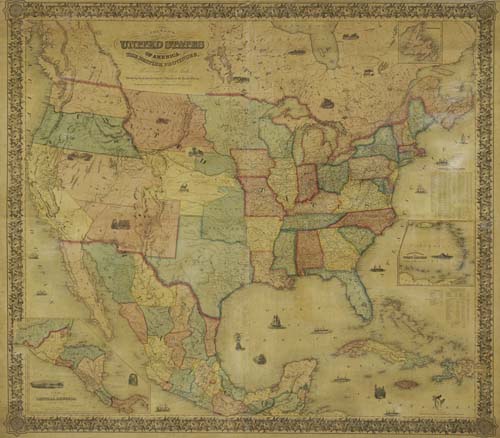
COLTON, J. H. Colton's Map of the United States of America, the British Provinces, Mexico and the West Indies. Hand-colored engraved wall map from 4 joined sheets, 1325x1500 mm overall; small 40x40 mm tear on image near top dowel, two small tears in margins; varnish with light but uniform browning; contemporary linen backing; original wooden dowels top and bottom, top dowel reattached with original tacks. New York, 1853

Additional Details


Shows all of the United States and Mexico. In the West a very interesting situation with the Indian Territory is shown. It entirely separates Nebraska Territory from Iowa and Missouri and in the northern part has large pieces of land attached to it representing the dwelling areas of various Indian tribes. North-West Territory is above Nebraska. There is no Nevada. Oregon and Washington Territories encroach on modern day Idaho. The border with Mexico is along the Gila River, showing the pre-Gadsden Purchase situation. West of the Texas, the border between New Mexico Territory and Mexico runs along a straight line labeled "Bartlett's Boundary". This map was initially based by Colton on an 1846 map published by J. Calvin Smith and engraved by Sherman and Smith. J.H. Colton was in partnership with J. Calvin Smith for some time in the 1830's and 1840's. Rumsey 2285. Ristow, page 318.