Dec 08, 2005 - Sale 2060

Sale 2060 - Lot 139

Price Realized: $ 5,060
?Final Price Realized includes Buyer’s Premium added to Hammer Price
Estimate: $ 4,000 - $ 6,000
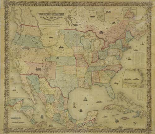
COLTON, J. H. Colton's Map of the United States of America, the British Provinces, Mexico and the West Indies. Hand-colored engraved wall map from 4 joined sheets, 1325x1520 mm overall; varnish with very little yellowing; contemporary linen backing; original wooden dowels top and bottom. New York, 1854

Additional Details


Kansas appears in the West for the first time as a separate Territory with its own full coloring but is not yet named "Kansas" on the map. The "North-West Territory" label is still on the map but that area is colored the same as the area labeled "Nebraska", suggesting that they are one and the same (i.e. Nebraska Territory). The Indian Territory loses the odd shape that it had on the 1853 edition of this map and is now shaped like modern day Oklahoma, without the panhandle. West of Texas, the border between New Mexico Territory and Mexico still runs along a straight line but is now labeled "Conde & Bartlett's Line."
This edition of the map is rare and was issued for only about a month between the dates of the Congressional Kansas/Nebraska Act which created Kansas (as on this map) and the ratification of the Gadsden purchase which added new territory to New Mexico south of the Gila River (not shown on this map). Rumsey notes that this 1854 edition of the map was the "source of the Nebraska/Kansas Pocket Map of 1854"--Rumsey 2834. Ristow, page 318.