Jun 07, 2018 - Sale 2481

Sale 2481 - Lot 54

Price Realized: $ 30,000
?Final Price Realized includes Buyer’s Premium added to Hammer Price
Estimate: $ 20,000 - $ 30,000
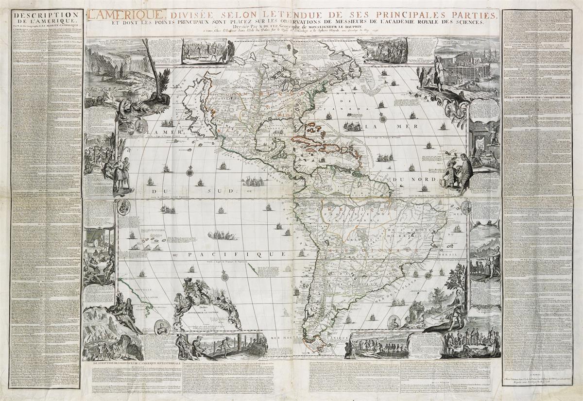
DE FER, NICOLAS. L'Amerique Divisee Selon Letendue de ses Principales Parties. Engraved decorative wall map of North and South America on four sheets joined, bordered by a separately engraved title banner and sheets of extensive explanatory text. 45 1/2x66 inches overall size, wide margins with untrimmed deckle edges; original outline hand-color; minor strengthening to versos of folds and joins. Paris, 1713 (but 1716)

Additional Details

Rather nice example of De Fer's rare wall map of the Americas. Pictorial vignettes surround and elaborate the geography, including many scenes of the inhabitants native to these American continents. Two important commercial elements of the New World are also prominently represented: the Newfoundland cod fishery and the beaver fur trade. The latter, here regarded as the first appearance of the industrious beaver scene against the backdrop of Niagara Falls later greatly popularized by Herman Moll. The cartography shows a very large depiction of California as an island and reflects contemporary Jesuit information of the Great Lakes and inland river systems. Dahl, Edward, "The Original Beaver Map" (TMC 29, pages 22-26); McLaughlin 165; Tooley, "California as an Island" 70.