Dec 08, 2016 - Sale 2434

Sale 2434 - Lot 40

Price Realized: $ 16,250
?Final Price Realized includes Buyer’s Premium added to Hammer Price
Estimate: $ 10,000 - $ 15,000
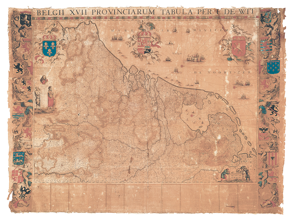
DE WIT, FREDERICK. Belgii XVII Provinciarum Tabula Per F. De Wit. Engraved wall map of the Netherlands on 9 sheets joined, bordered on left and right by separately engraved decorative heraldic arms of the Seventeen Provinces, four sheets of descriptive letterpress text in Latin and Dutch forming the lower border. Overall approximately 60x78 inches; original hand-color; backed on old linen, toned with some surface soiling, dampstain in upper right corner, edges frayed, soft creases throughout resulting in minor losses of printed matter. Amsterdam, circa 1670

Additional Details

a rare survival from the dutch golden age: The true first state of Frederick De Wit's important nine-sheet wall map of the Seventeen Provinces. Only two copies of the first state can be located: uncolored in 9 loose sheets at Leiden University Library which lacks the decorative border and text sheets, and a mounted copy at Le Service Historique de la Marine, Vincennes. By comparison to the Leiden copy, several stylistic and cartographic differences indicate the present copy is an even earlier state. Wall maps of this nature, the sort famously seen hanging in the backgrounds of several well known Vermeer paintings, are rarely preserved. Though not without its faults, this map survives very well: A champion of artistic, cartographic and bibliographic significance. Schilder, Monumenta Cartographica Neerlandica Vol. I 12; Van der Heijden, Old Maps of the Netherlands, pages 478-484.