Dec 09, 2004 - Sale 2027

Sale 2027 - Lot 92

Price Realized: $ 1,380
?Final Price Realized includes Buyer’s Premium added to Hammer Price
Estimate: $ 800 - $ 1,200
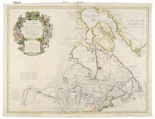
DELISLE, GUILLAUME. Carte du Canada ou de la Nouvelle France. Double-page engraved map, 500x655 mm, ample margins; hand-colored; a few minor wormholes repaired. Paris, 1703 [but 1708-12]

Additional Details


The fourth state (of 9), indicated by the address line in the cartouche and the removal of the Amsterdam imprint above the mileage scales. "Del'Isle's map of Canada is one of the most outstanding maps of Canada of the 17th and early 18th centuries. Typical of all of his work, the information that went into his map of Canada was the result of careful and painstaking research . . . Del'Isle's careful research resulted in the first map of Canada to present the whole of the Great Lakes correctly . . . Of considerable significance, the geography of the coastal regions of James and Hudson's Bays, together with their major river systems is presented by Del'Isle with a surprising degree of accuracy"--Kershaw I:311 (quoted from page 275).