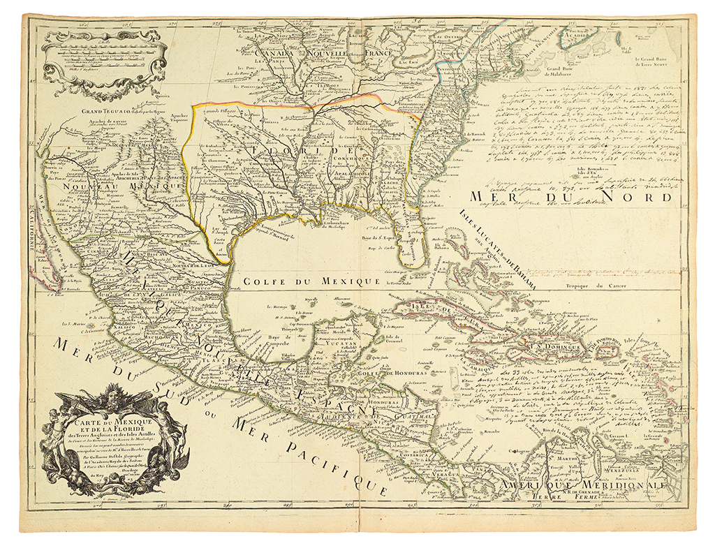
DELISLE, GUILLAUME. Carte du Mexique et de la Floride des Terres Angloises et des Isles Antilles. Large double-page engraved map of North America bounded by the Gulf of California, the Great Lakes, and the Isthmus of Panama. 475x640mm image size, margins at platemark on top and sides; old outline hand-color; extensive 19th century manuscript additons, mainly in the Atlantic but also adding toponyms, lower centerfold reinforced on verso. Tooley, French Mapping of America, 52, state 3 of 5. Paris: Delisle, 1703 [but 1708]