Dec 08, 2016 - Sale 2434

Sale 2434 - Lot 37

Price Realized: $ 11,250
?Final Price Realized includes Buyer’s Premium added to Hammer Price
Estimate: $ 5,000 - $ 7,500
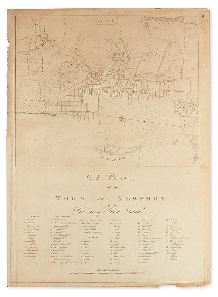
DES BARRES, JOSEPH FREDERICK WALLET. A Plan of the Town of Newport in the Province of Rhode Island. Large engraved map of Newport, with descriptive key below. On laid paper bearing "LVG" watermark; 29 3/4x21 3/4 inches sheet size, lower right margin with small loss and discoloration not affecting imprint, upper part of left margin a bit jagged, old repair on verso of small puncture near compass rose, overall light age toning. An attractive, unsophisticated example in the rare first state. [London:] J. F. W. Des Barres, April 24, 1776

Additional Details

From Des Barres' monumental mariners atlas, the Atlantic Neptune: the most accurate and detailed coastal charts of the eastern seaboard of North America surveyed and assembled in the eighteenth century. In this chart the contemporary scant layout of the town of Newport is depicted with the corresponding key referencing its wharfs, public buildings and streets; a fortified Goat Island insulates the inner reaches of the harbor. Stevens 87A.