Jun 19, 2003 - Sale 1974

Sale 1974 - Lot 82

Price Realized: $ 1,725
?Final Price Realized includes Buyer’s Premium added to Hammer Price
Estimate: $ 1,200 - $ 1,800
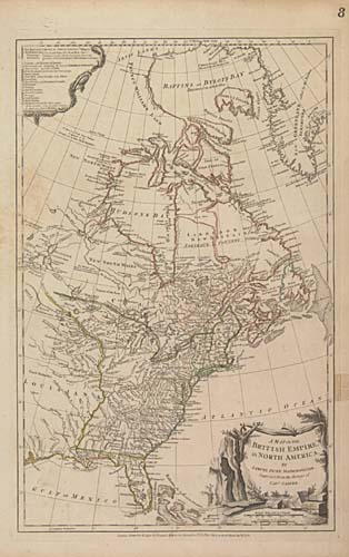
HOLSTER MAP DUNN, SAMUEL. A Map of the British Empire in North America. Engraved map, without folds, 495x320 mm, wide margins; hand-colored in outline; small stain in the right margin outside the neat line. London: Sayer & Bennett, 1776

Additional Details


"The maps that the British high command regarded as providing essential topographical information in the most convenient form were collated in The American Military Pocket Atlas published by the firm of Robert Sayer and John Bennett in 1776. The book, known as the Holster Atlas because during the war it was carried by British officers in their holsters, included six large folding maps"--Schwartz & Ehrenberg, page 190.