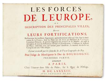
FER, NICHOLAS DE. Les Forces de l'Europe, ou description des principales villes aves leurs fortifications. . .pour l'usage de Monseigneur le Duc de Bourgogne. 175 engraved plans and views, of which one folding. 8 parts in 1. Oblong folio, 11x15 inches, contemporary mottled calf, spine with raised bands in six compartments, lettered in the second, the others with a repeat decoration in blind, lightly worn. Armorial bookplate of Algernon Capell, Earl of Essex, on verso of dedication leaf. Paris: Chez l'Auteur, 1693-1696
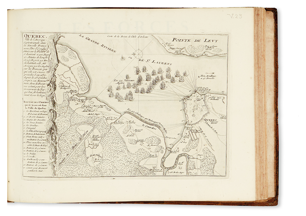
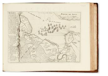
Although predominantly maps, plans and views of fortifications of European cities in France, Germany, and the Netherlands, the atlas also includes a number of other regions, including Malta, Constantinople, Tripoli and elsewhere. Among the most interesting of these is the plan of Quebec (Kershaw 279), bound as the map 23 in part 5. Phillips, Atlases in the Library of Congress, 517a; Shirley, Maps in the Atlases of the British Library, T.Fer-1c; Pastoureau, Les Atlas Francais XVle-XVlle Siecles, Fer IX A.