Jun 20, 2002 - Sale 1940

Sale 1940 - Lot 86

Price Realized: $ 4,140
?Final Price Realized includes Buyer’s Premium added to Hammer Price
Estimate: $ 4,000 - $ 6,000
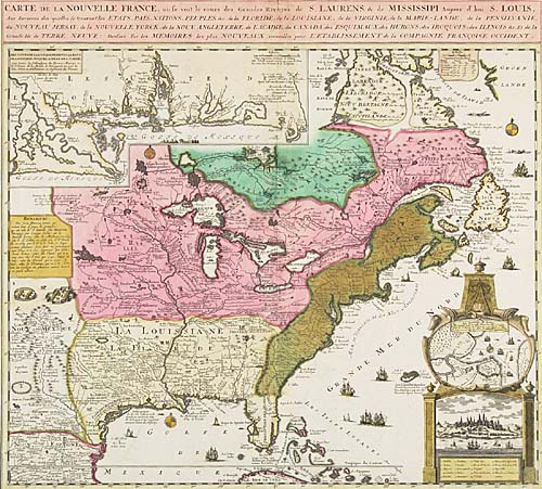
FER, NICOLAS de; after. Carte de la Nouvelle France, ou se voit le cours des Grandes Rivieres de S. Laurens & de Mississipi. Double-page engraved map, 505x550 mm, wide margins; nicely hand-colored; mounted; nicely framed. Amsterdam?, circa 1719

Additional Details


This lovely and uncommon map is based on De Fer's large 4-sheet depiction of the region published in 1718 and is similar to one which appeared in Chatelain's Atlas Historique, but this version was published separately, is slightly larger, has different borders around the insets and contains no engraved volume and page number. It depicts the entire eastern seaboard as far north as Hudson's Bay and as far west as "Nouv Mexique," contains an inset map of the Mississippi delta region, two insets of Quebec and numerous details of wildlife, Indians, ships, etc. McCorkle 719.5; Kershaw II:336.<