Dec 08, 2005 - Sale 2060

Sale 2060 - Lot 30

Price Realized: $ 4,370
?Final Price Realized includes Buyer’s Premium added to Hammer Price
Estimate: $ 5,000 - $ 7,500
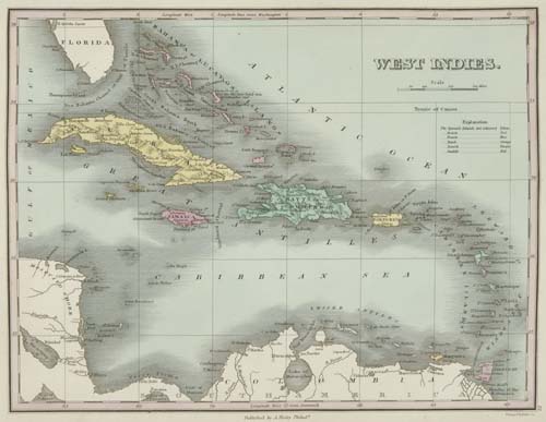
FINLEY, ANTHONY. A New General Atlas. Bound with, as issued: Atlas Classica; or Select Maps of Ancient Geography, both Sacred and Profane. Engraved title, 58 maps, 2 charts and 1 table in the General Atlas, all hand-colored; 9 maps and 3 charts in Atlas Classica, all hand-colored; plus 30 additional maps bound in giving examples of states or issues. 4to, 350x275 mm, modern morocco; exceptionally bright and clean internally. Philadelphia, 1830; 1829

Additional Details


There are 32 maps in the General Atlas that show the Americas, including one for each of the U.S. states. This Finley General Atlas was the most popular American atlas until the appearance of Tanner's New Universal Atlas in 1836. It was published from 1824 until 1834 - with Finley constantly updating the maps. For example, this 1830 copy of the General Atlas contains only 2 double-page maps as issued - those of New York and Pennsylvania. Many of the maps in this atlas were updated 4 or 5 times between 1824 and 1834 resulting in a large number of states/variants for each map. This is a collector's copy of the General Atlas, with the owner taking advantage of the rebinding of the atlas to insert extra maps. And thus, in addition to a complete set of 60 maps and charts for the 1830 edition of the atlas (as called for in the Index) there are 30 additional maps inserted - 26 by Finley (most from the 1832 edition of his General Atlas, including the rare map of Florida which appeared in the 1831 edition for the first time), 1 by Tanner (Germany), 1 by Fielding Lucas (Connecticut), 1 by S.C. Atkinson (Kentucky, engraved by J. Yeager), 1 published by T. R. Tanner - Henry S. Tanner's son (Mississippi, originally published by Finley - from T.R. Tanner's unrecorded New General Atlas, 1846 - see lots 50 and 51). Interesting collation - for example, including the original 1830 map there are 4 Finley maps of New Jersey in this composite copy - from the 1824, 1828, 1830, 1832 editions of the atlas - each in a different state. The 1830 edition not in Rumsey.