?Final Price Realized includes Buyer’s Premium added to Hammer Price
Estimate: $ 30,000 - $ 50,000
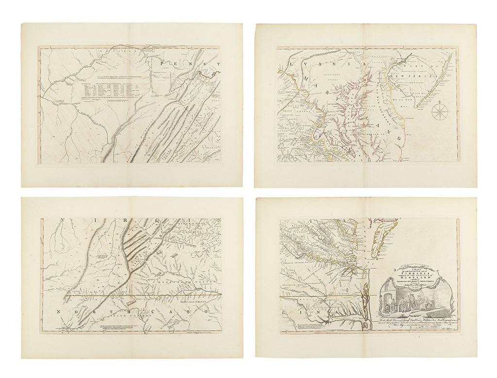
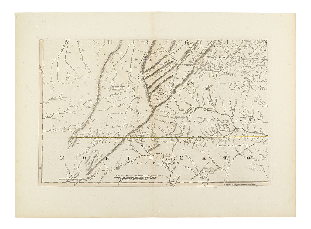
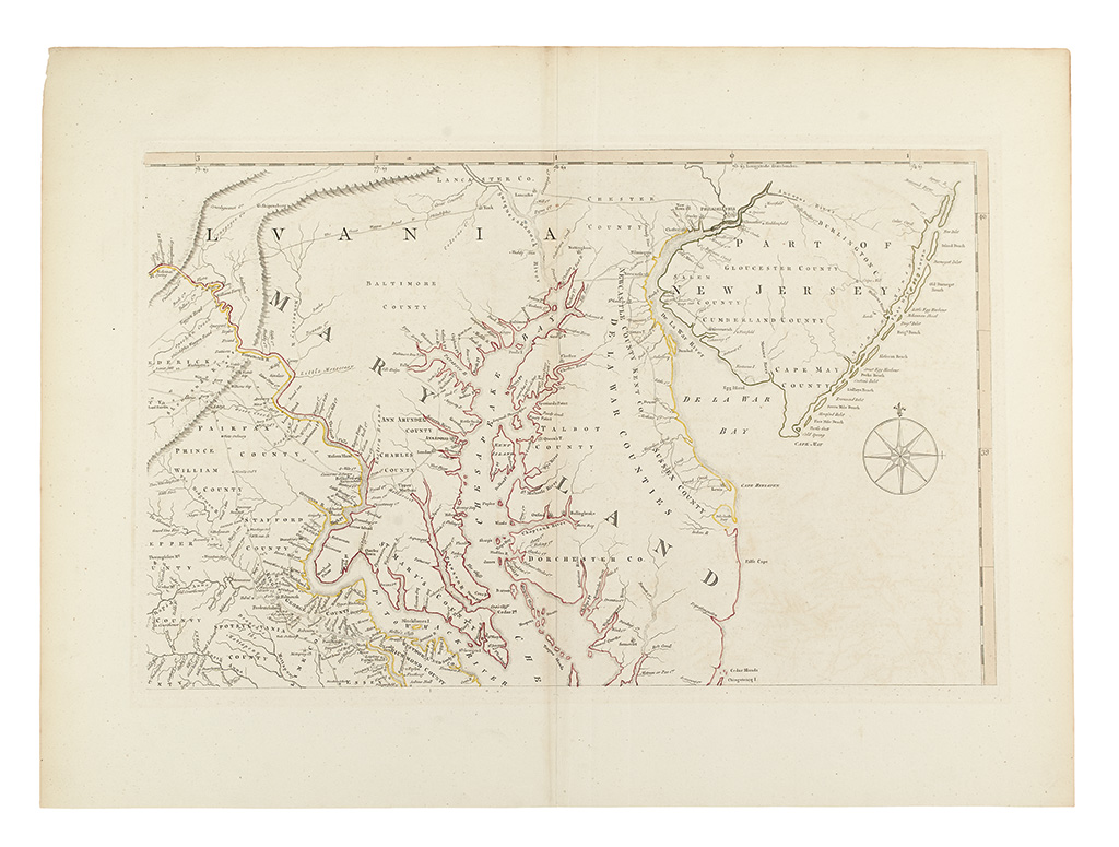
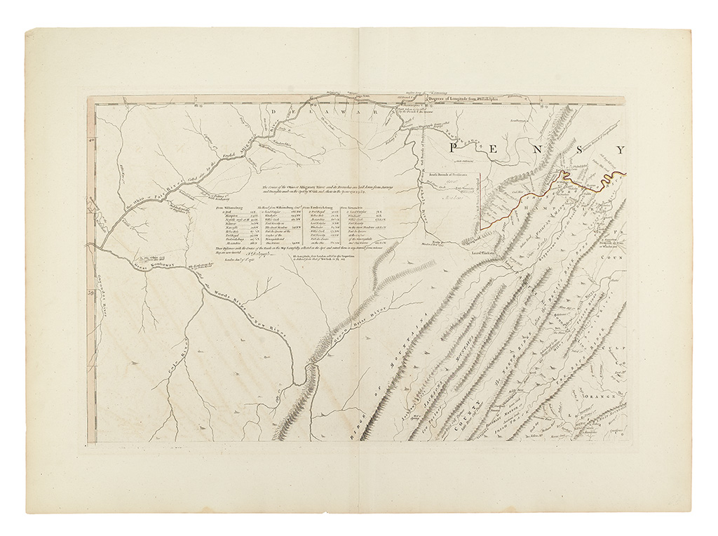
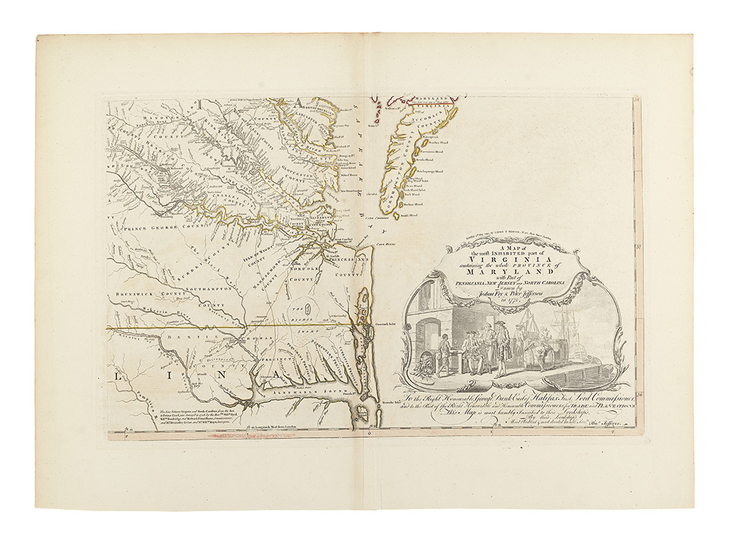
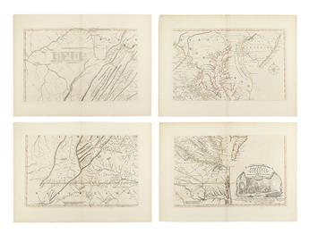
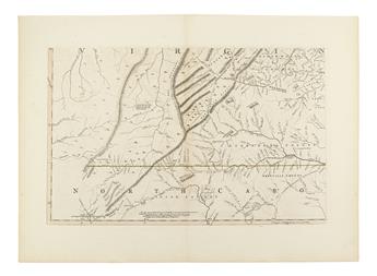
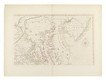
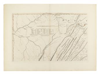
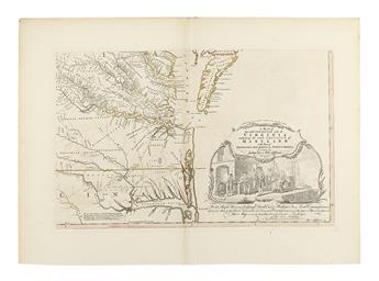
THE EXTREMELY RARE 1794 FINAL STATE OF THE MAP. FRY, JOSHUA; and JEFFERSON, PETER. A Map of the most Inhabited part of Virginia containing the wholeProvince of Maryland with part of Pensilvania, New Jersey and North Carolina. Four engraved double-page mapsheets, unjoined, constituting one large map of Virginia. Each sheet 550x760 mm, very wide margins, blank verso; original hand-color in outline, in the Laurie and Whittle style; old imprint along bottom neatline forcibly erased from image. Overall a truly beautiful example of the map. London: Laurie & Whittle, 12 May 1794
This is the exceptionally rare 1794 final issue of the cornerstone Fry & Jefferson map of Virginia. We record only one example at auction in more than 50 years of records, and, in 1966, Malone said of the 1794 issue: 'There are only two recorded copies of this printing of the map."
During the American Revolution, the Fry & Jefferson map saw prolific publication by the firm of Robert Sayer; it was included in Jefferys' American Atlas, Faden's North American Atlas and issued separately [see Stevens & Tree 87(f)]. However after the Treaty of Paris, there was diminished demand in England, and there were no updates to the map for almost two decades. After Sayer's death in 1794, his assistants Robert Laurie and James Whittle quickly changed the imprints on many of the maps he had published, to reflect their new roles in the firm. However by that time the map could hardly be called up-to-date, and it saw only a very limited run.
Malone, The Fry and Jefferson Map of Virginia, page [21]; Stevens & Tree 87(g); Taliaferro, "Fry and Jefferson Revisited", state 9; Pritchard & Taliaferro, Degrees of Latitude, 30, state 8.