Mar 22, 2007 - Sale 2108

Sale 2108 - Lot 121

Price Realized: $ 2,160
?Final Price Realized includes Buyer’s Premium added to Hammer Price
Estimate: $ 1,000 - $ 1,500
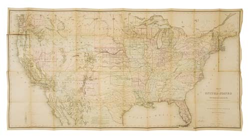
GENERAL LAND OFFICE. Map of the United States and Territories. Hand-colored engraved folding case map, approximately 29x56 inches, folds into contemporary morocco gilt with the seal of the Land Office and the name of early California Governor and Congressman Milton S. Latham in gilt, a bit scuffed; linen-backed at a contemporary date, map separated from the panel which is mounted to the covers, other more minor separations. New York: Fred Mayer and Sons, 1868 [but 1869-70]

Additional Details

An important map depicting the continental U.S., showing the progress of the routes of the Pacific Railroads, the locations of numerous cities, towns and forts, the various mineral deposits west of the 100th meridian and an early mapping of wyoming territory not found on the earlier General Land Office maps. The map is dated 1868 in the cartouche, but Commissioner Joseph Wilson's printed statement on the map is dated November 1869. Further, the seal on the covers identifies the map as being issued with the 1870 Annual Report of the General Land Office. This reissue of the General Land Office maps of 1866 and 1867 is not noted in Wheat, Mapping the Transmississippi West. with a nice early california provenance.