Dec 06, 2007 - Sale 2131

Sale 2131 - Lot 78

Price Realized: $ 1,680
?Final Price Realized includes Buyer’s Premium added to Hammer Price
Estimate: $ 1,000 - $ 1,500
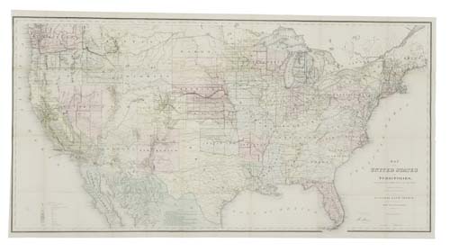
GENERAL LAND OFFICE. Årsberättelse ap Chefen för Förenta Staternas Generallandkonton, 1869. With hand-colored "Map of the United States and Territories," measuring 760x1440 mm; few minor separations at intersecting folds. 8vo, original gilt-lettered cloth; map laid in. Washington, 1871; map dated 1870

Additional Details

Volume was issued by the United States government to attract Swedish immigrants to the country. In addition to its interest as an Americana item, the map which accompanied the volume is important. It is one of the earliest maps showing Wyoming Territory. The first issue of the map appeared in November 1869. The copyright date on this issue is 1870.