Dec 06, 2007 - Sale 2131

Sale 2131 - Lot 89

Price Realized: $ 14,400
?Final Price Realized includes Buyer’s Premium added to Hammer Price
Estimate: $ 20,000 - $ 30,000
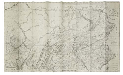
HOWELL, READING. A Map of the State of Pennsylvania. Engraved four-sheet map joined, 940x1600 mm overall, margins trimmed close; scattered minor soiling, several small wormholes; backed with paper. London, 1792

Additional Details

Most important Pennsylvania map of the 18th century. Howell was commissioned by the state in 1790 to produce the map. It is the first map to correctly show the borders of the state and it served as the basis for many other maps of the state, most notably Samuel Lewis''s map which appeared in Carey''s American Atlas (1795). It remained the greatest mapping of the state until John Melish''s map of 1822. The map was also issued in smaller format in 1792.
Each of the sheets appeared in a number of states. This copy is a mix of states as is usually the case. Sheets 1 and 3 are in the first state, sheet two is in the second state, and sheet four is in the third state. Wheat & Brun 433-35; Ristow, pages 108-110; Phillips, Maps 679.