Jun 19, 2008 - Sale 2150

Sale 2150 - Lot 96

Price Realized: $ 168,000
?Final Price Realized includes Buyer’s Premium added to Hammer Price
Estimate: $ 60,000 - $ 90,000
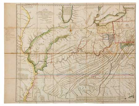
HUTCHINS, THOMAS. A New Map of the Western Parts of Virginia, Pennsylvania, Maryland and North Carolina; Comprehending the River Ohio [etc.]. Large 3-sheet engraved case map in 32 sections; 935x1210 mm overall; hand-colored in outline when issued; trimmed to neat line along left edge and remargined in the 1780s to allow for a manuscript list of additions to the engraved map; small area of browning in the area of Illinois Country, small dark partial ring (from a coffee cup?) in the area of the Ouasioto Mountains; with original linen-backing; with the original board slipcase. London, 1778

Additional Details

Foundation map for the Ohio Valley and the trans-Allegheny region. It is the first large-scale mapping of the area by a master cartographer. The map developed from personal observations and reckonings taken by Hutchins while in military service during the 1760s. His knowledge of the area allowed Hutchins to add commentary to his map beyond a simple mapping. He describes places in terms of their natural assets. It is also one of the few maps of the period to show the proposed colony of Vandalia, indicated on the map as "Indiana."
The map was issued separately, but intended to serve as a complement to Hutchins'' "Topographical Description" which appeared simultaneously with the map. With its publication it became the most influential map of the area and informed future mappings through the rest of the 18th century. For example, the map in Jefferson''s Notes on Virgina is taken directly from Hutchins.
Hutchins was an interesting character himself. Orphaned as a child, he made his way into military service and the Engineers Corps of the British forces operating in the mid-West. He was jailed in Britain during the Revolutionary War because he would not fight against the American revolutionaries. He escaped and eventualy returned to the United States. He continued to produce outstanding maps and his service was rewarded by Congress appointing him "Geographer to the United States."
this copy is a unique example with important manuscript additions from around 1790, with changes noted in different outline coloring and the addition of capital letters and boundary lines which are keyed to a "Reference" list in the left margin. These additions note very important changes in the commercial and political landscape of the period between 1778 and the late 1780s, including the creation of the Seven Ranges, the Ohio & Scioto Company, Symmes & Company lands, Wabash Company, Illinois Company, and even the founding of Knoxville, TN (1786). Both the manuscript additions and the additional outline color are so neatly done as to suggest that the map may have been of official issue.