Dec 08, 2005 - Sale 2060

Sale 2060 - Lot 35

Price Realized: $ 1,265
?Final Price Realized includes Buyer’s Premium added to Hammer Price
Estimate: $ 1,500 - $ 2,500
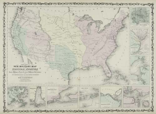
JOHNSON, A. J. Johnson's New Illustrated (Steel Plate) Family Atlas, with Descriptions, Geographical, Statistical and Historical. Frontispiece, profusion of hand-colored mapsheets. Folio, 455x380 mm, publisher's 1/2 morocco; slight to moderate toning throughout, as usual. New York: Johnson and Browning, 1862

Additional Details


Early 1862 edition. This is the last edition of the Johnson Atlas to be published by Johnson & Browning. The late 1862 edition is already published by Johnson & Ward. This early issue contains Johnson's New Military Map of the United States Showing the Forts, Military Posts & all the Military Divisions. This is the scarce first issue of this map without any state boundaries, but showing the boundaries of the seven military districts. This map appeared only in the late 1861 and early 1862 editions of this atlas. Beginning with the late 1862 edition, the map was changed to show the state boundaries and the boundaries of the military districts were eliminated. Not in Rumsey.