LAHONTAN, LOUIS ARMAND, BARON DE. Voyages . . . dans l'Amerique Septentrionale and Memoires de l'Amerique Septentrionale. 2 large folding maps, 2 smaller maps, and 22 plates. [18], 376; [3]-336, [2] pages. 12mo, mixed issues in matching contemporary calf, rejointed; minor dampstaining, minor wear to maps; early armorial bookplates on verso of title pages. In an attractive modern full-calf embossed folding case. The Hague and Amsterdam, 1705
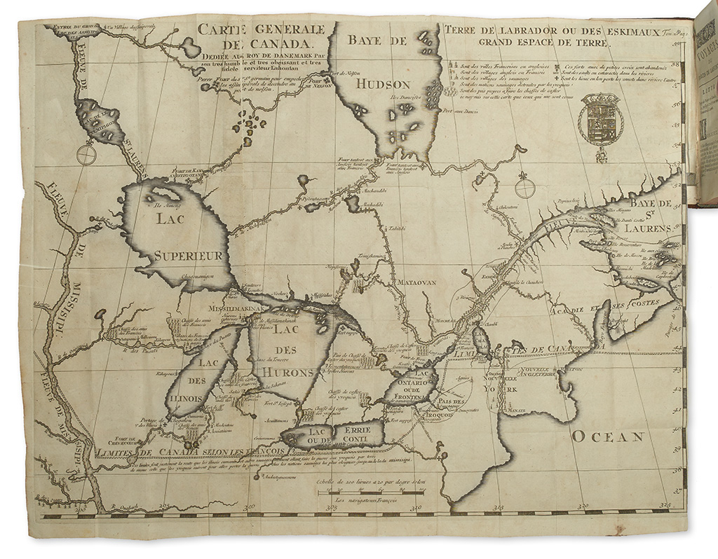
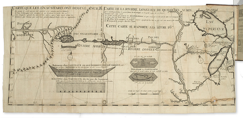
Stated second edition of Lahontan's travels in the old northwest. Includes two large folding maps: "Carte Generale de Canada" (17 x 22 inches on two conjoined sheets), showing part of the Mississippi, all five Great Lakes, Hudson Bay, and the Atlantic Coast and "Carte que les Gnacsitares ont dessiné Sur" (12 x 26 1/2 inches on two conjoined sheets), consisting mostly of a spurious depiction of the territory west of the Upper Mississippi, some of it allegedly obtained from Indian informants. European Americana 705/109-110; Sabin 38641-2 (incorrect collation); Wheat, Transmississippi West 90 and page I:61 ("Lahontan's map was striking--almost believable").