?Final Price Realized includes Buyer’s Premium added to Hammer Price
Estimate: $ 600 - $ 900
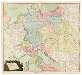
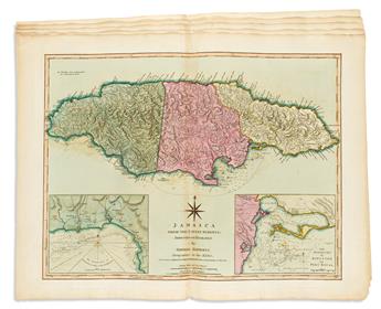
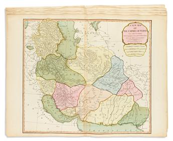
LAURIE & WHITTLE. Group of 7 double-page or folding hand-colored engraved maps. Various sizes, on sheets of "JWhatman/1808" watermarked wove paper; fine original hand-color in full; light offset and minor edge chips, one unobtrusive repair. London, vd but circa 1810
- A New Map of the Seat of War, Comprehending Germany; Poland, with its Dismemberments, Prussia; Turkey in Europe, Italy &c, from the Maps of Chauchard, Zannoni, &c.
- Jamaica from the Latest Surveys; Improved and Enlarged by Thomas Jefferys Geographer to the King.
- Kingdom of Hungary, Principality of Transilvania, Sclavonia, Croatia, with a Part of Valakia, Bulgaria, Bosnia and Servia.
- A New Map of the Electorate of Bavaria.
- A New Map of the Empire of Persia from Mons.r D'Anville.
- The Kingdom of Prussia, and its Newly Incorporated Province of Polish Prussia Now Named Western Prussia; with the Territory of Dantzick; by John Roberts.
- A Map of the Electorate of Brandenburg, Including Western Pomerania, and the Greatest Part of the Dutchies of Mecklenburg and Magdeburg.