Dec 08, 2005 - Sale 2060

Sale 2060 - Lot 71

Price Realized: $ 3,680
?Final Price Realized includes Buyer’s Premium added to Hammer Price
Estimate: $ 2,000 - $ 3,000
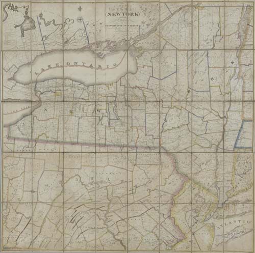
LAY, AMOS. Map of the State of New-York with part of the States of Pennsylvania, New Jersey &c. . . . Second Edition. Engraved 6-sheet map joined and dissected to form 40 sections, 1305x1305 mm overall; hand-colored in outline; scattered minor foxing; linen-backed, small split at one insterseting fold (without loss); housed in a modern cloth folding box. New York, 1822

Additional Details


Third Edition. Although this 1822 map is styled "Second Edition" in title, just like the one published in 1820, it is actually the 3rd edition. Compared with the 1820 map the following changes, additions, revisions were made on this map: The date "1817" following Lay's name in title has been removed. Wayne and Yates counties have been carved out of Ontario and Seneca counties. Tompkins county is enlarged on south at the cost of Tioga county. Tioga county has expanded eastward at the cost of Broome county - to include Town of Owego. Livingston county is enlarged at the cost of Steuben county - to include Town of Danville. The border between Herkemer and Hamilton counties have been adjusted at the detriment of Herkemer county. Oneida county is now present. In addition, a number of county names, previously printed on the map in small narrow letters, have been reset to large and wide letters throughout the state, primarily in the west. Ristow, page 99. Not in Rumsey.