Dec 08, 2005 - Sale 2060

Sale 2060 - Lot 142

Price Realized: $ 10,350
?Final Price Realized includes Buyer’s Premium added to Hammer Price
Estimate: $ 1,500 - $ 2,500
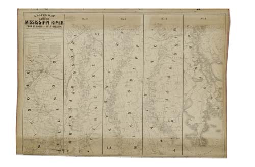
LLOYD, J. T. Lloyd's Map of the Lower Mississippi River from St. Louis to the Gulf of Mexico. With--Lloyd's New Map of the United States, the Canadas and New Brunswick. Together, 2 lithographed wall maps, one on the verso of the other, the first uncolored, each 930x1375 mm overall; two 80-mm tears extending into images from the bottom dowel; varnish on second is quite clear, first map unvarnished but with slight yellowing at top and bottom; both maps mounted to same piece of linen; original wooden dowels top and bottom. New York, 1863; 1864

Additional Details


While in Lloyd's days the fully colored map of the United States elicited much more interest than the uncolored Map of the Mississippi, the opposite is true in the present. The map of the Mississippi is in five panels with the names of the lot owners adjoining the Mississippi and the borders of their lots shown in minute detail. It is quite possibly the most detailed map of the Mississippi from the 1860s. Basically, there were only two editions of this Mississippi map, published in 1862 and 1863. The Mississippi map was republished in 1875 in a long strip form. Rumsey 4472.