Jun 19, 2003 - Sale 1974

Sale 1974 - Lot 101

Price Realized: $ 1,380
?Final Price Realized includes Buyer’s Premium added to Hammer Price
Estimate: $ 2,000 - $ 3,000
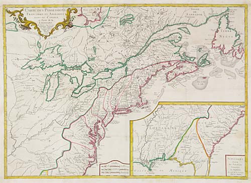
LONGCHAMPS, S. G. Carte des Possessions Francoises et Angloises dans le Canada, et Partie de la Louisiane. Engraved folding map, 535x750 mm image size, trimmed to the neat line and remargined; hand-colored in outline; minor restoration along folds. Paris, 1756

Additional Details


With a large inset of the Southeast. "Covers the area east of the Mississippi River from James Bay to the Gulf of Mexico. Shows provinces, select towns and cities, forts, Indian villages and tribal territory, and relief"--Sellers and Van Ee 70; McCorkle 756.9.