?Final Price Realized includes Buyer’s Premium added to Hammer Price
Estimate: $ 2,000 - $ 3,000
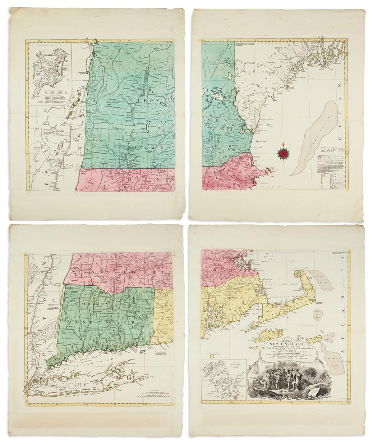
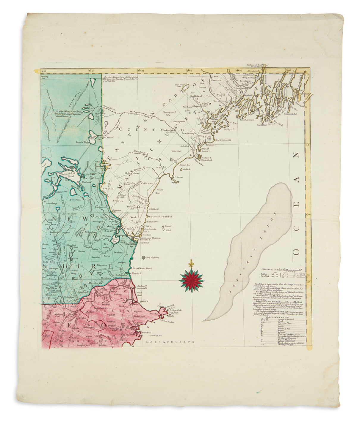
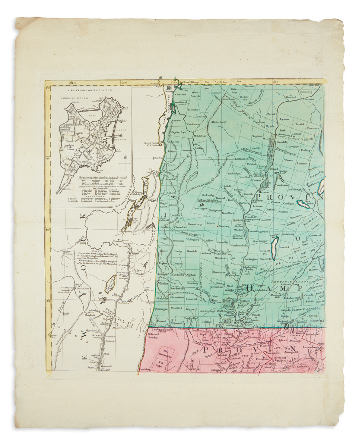
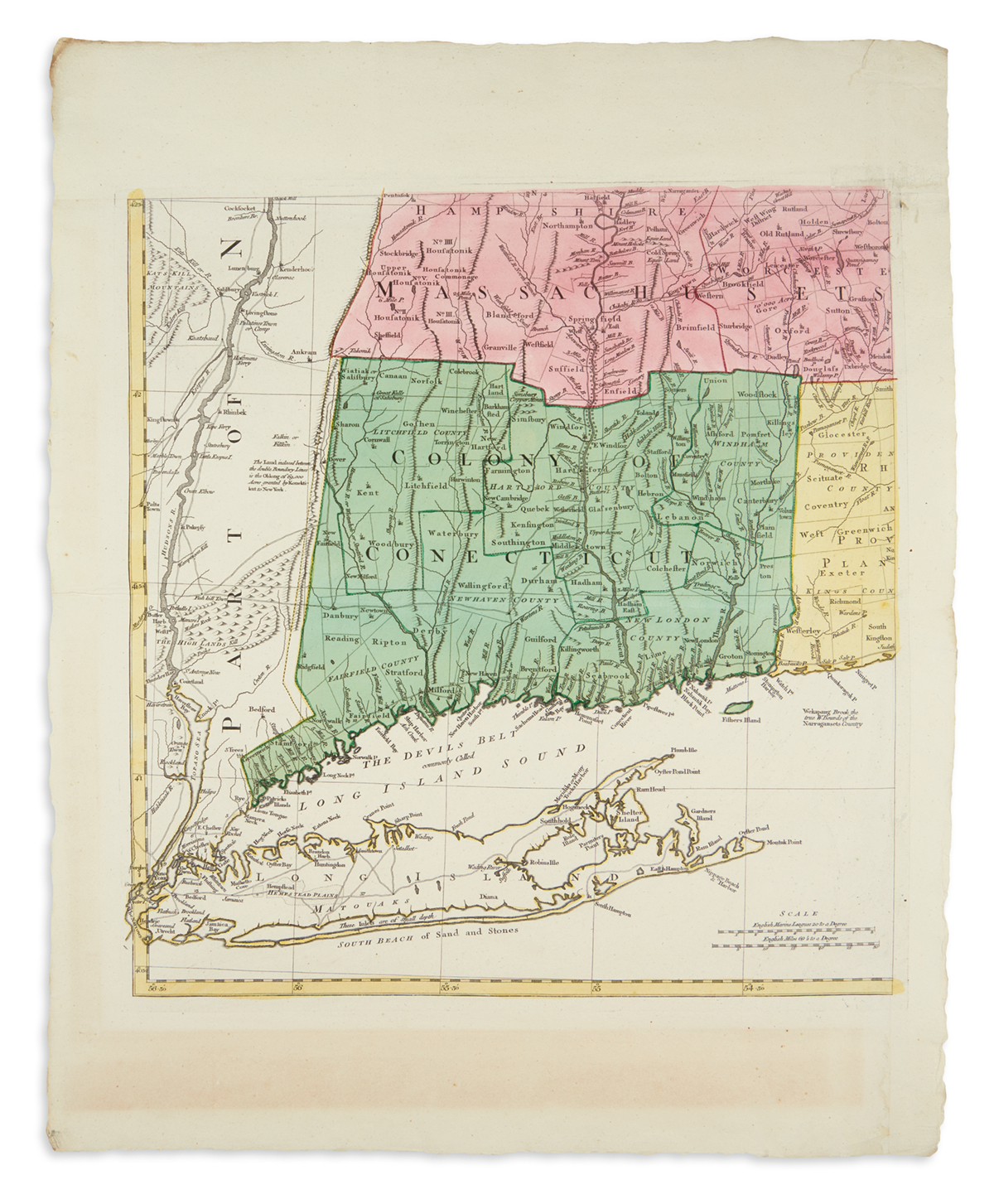
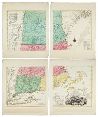
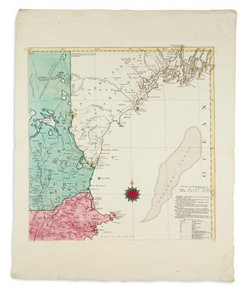
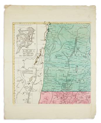
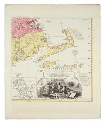
LOTTER, TOBIAS CONRAD; after MEAD, BRADDOCK, alias GREEN, JOHN. A Map of the Most Inhabited Part of New England,Containing the Provinces of Massachusets Bay and New Hampshire, with the Colonies of Conecticut and Rhode Island, Divided into Counties and Townships the Whole Composed from Actual Surveys and its Situation Adjusted by Astronomical Observations. Four unjoined double-page engraved mapsheets constituting one large map of New England. 22 1/2x28 inches each sheet size, wide margins with untrimmed deckle edges; original hand-color in full; minor edge soiling and small repairs; an excellent preservation of the original mapsheets as issued. Augsburg, 1776