Jun 07, 2018 - Sale 2481

Sale 2481 - Lot 136

Price Realized: $ 7,000
?Final Price Realized includes Buyer’s Premium added to Hammer Price
Estimate: $ 4,000 - $ 6,000
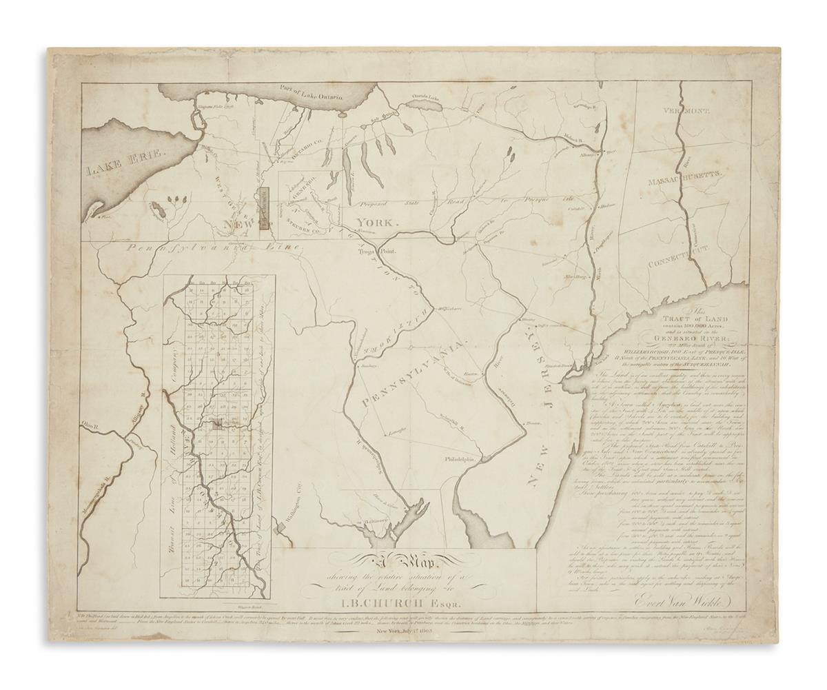
MANGIN, JOSEPH FRANCOIS. A Map Shewing the Relative Situation of a Tract of Land Belonging to J.B. Church Esqr. Map of New York State, New Jersey and portions of Pennsylvania. Engraving by Peter Maverick with manuscript additions; 16 1/2x20 1/2 inches sheet size, wide margins; manuscript additions; folded but flattened and stabilized on verso with a heavier stock, light soiling and offsetting, several tears closed on backing. New York, July 1st, 1803

Additional Details

A remarkable document relating to the early settlement of western New York. This undeveloped 100,000-acre tract on the Genesee River in western New York had been used to repay a debt to John Barker Church from financier Robert Morris. Church was a major supplier to the French and American armies during the Revolution and Morris, unable to satisfy his obligations, repaid Church with this property. A prospectus appears at lower right by Church's land agent, Evert van Wickle, relating to potential settlers the quality and situation of the land as well as outlining incentives to purchase and build around the newly formed village of Angelica in Allegany County. An engraved note in the lower margin describes a "Road (as laid down in Red Ink) from Angelica to the mouth of Ishua Creek, will certainly be opened by next Fall." This would have been attractive to turn of the nineteenth century settlers, seeing Ishua Creek flowing into the Allegheny River, consequently connecting it to Pittsburgh and other points west. That proposed road appears in red ink in both the larger general map and the inset plan of the tract and is keyed with a manuscript letter A. The map overall is quite sparse, mainly noting existing and other proposed "waggon roads" throughout the tri-state region.

Joseph Mangin was a New York City surveyor whose most important published achievement was a collaboration with Casimir Goerck to create a large-scale detailed plan of the city. That plan was engraved in New York by Peter Maverick and printed in 1803. The present map was also engraved by Maverick in the same year and is similarly scarce. OCLC locates three copies of an 1804 edition and just two examples of this 1803.