Dec 03, 2009 - Sale 2198

Sale 2198 - Lot 16

Price Realized: $ 7,200
?Final Price Realized includes Buyer’s Premium added to Hammer Price
Estimate: $ 8,000 - $ 12,000
MELISH, JOHN. A Military and Topographical Atlas of the United States. 3 single-page engraved maps in text, 5 engraved folding maps removed and housed in modern cloth chemise; folding maps hand-colored in outline. 8vo, publisher's 1/2 roan, extremities rubbed; modern interleaves inserted where folding maps were removed; defects noted below; owner's signature of Rufus Stewart, Capt. 31st U.S. Infantry and dated in Burlington on 24 May 1814; modern cloth slipcase. Philadelphia, November 1813

Additional Details

Collation is confusing as the various parts are bound out of order: A Military and Topographical Atlas - 6 pages, plus Military Districts (bound at rear) 44 pages Description of the Seat of War - 3-34 pages Description of East and West Florida - 3-18 pages; Official Documents relative to the Operations of the British Army - 3-29 pages. S&S 29143; 29141; 29139; 29144. Final 3 listings lack the formal title-pages.
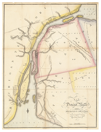
Single-page maps bound into the volume are variously foxed and browned; Map of the American Coast has a 90-mm closed tear and folds are reinforced on verso; Map of the Detroit River has folds reinforced on verso; Plan of Quebec with folds reinforced on verso; Map of the Southern Section of the United States has a 100-mm closed tear and the folds are reinforced on the verso; Map of the Seat of War in North America is lacking a triangular piece on the image in the lower right quadrant in the area of Nova Scotia (70x80 mm) and has some minor loss along the folds.