Dec 09, 2004 - Sale 2027

Sale 2027 - Lot 151

Price Realized: $ 5,750
?Final Price Realized includes Buyer’s Premium added to Hammer Price
Estimate: $ 4,000 - $ 6,000
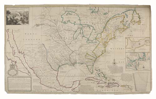
MOLL, HERMAN. A New Map of the North Parts of America claimed by France. Two-sheet engraved map, 620x1030 mm sheet size, trimmed close just outside neatline; hand-colored in outline; a bit toned overall, minor staining along right side, bottom corners chipped with minor loss to gradients. thomas w. streeter's copy with his booklabel on verso of the map. London, 1720

Additional Details


The first state, with the inset of Sasquesahanok and "Ye" instead of "the" in the title. This copy a variant issue, with additional names in the imprint. This impressive map of the U. S. depicts California as an island and a large section of the West is merely identified as "Parts Unknown." Moll's mapping of the southwest on this map is largely derivative of Delisle's famous map of 1718 (the first to name Texas). Streeter Sale 119 [this copy]; Siebert Sale 673; McLaughlin 197; Wheat, Mapping the Transmississippi West 105.