Dec 08, 2016 - Sale 2434

Sale 2434 - Lot 143

Price Realized: $ 1,500
?Final Price Realized includes Buyer’s Premium added to Hammer Price
Estimate: $ 1,500 - $ 2,500
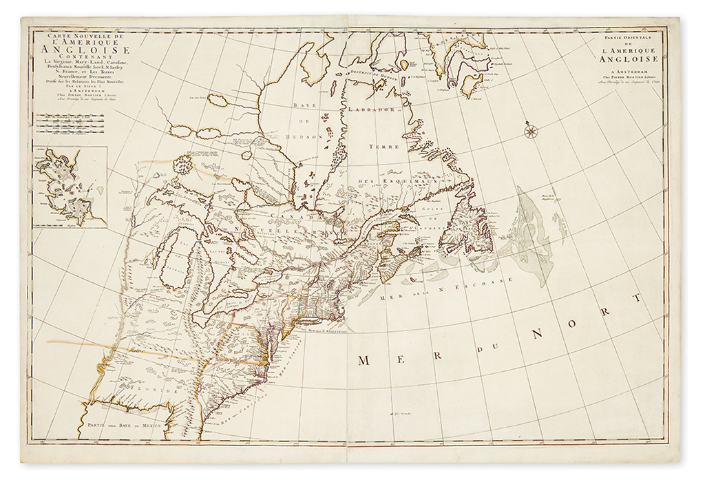
MORTIER, PIERRE. Carte Nouvelle de l'Amerique Angloise Contenant la Virginie, Mary-Land, Caroline, Pensylvania, Nouvelle Iorck, N: Iarsey, N: France, et les Terres Nouvellement Decouerte. Dresse sur les Relations les Plus Nouvelles par le Sieur S. Double-page engraved map of eastern North America with oversize Great Lakes on two sheets, joined on verso with linen. 25x37 inches sheet size, margins ample; original hand-color in outline; an attractive, clean copy. Amsterdam, circa 1700

Additional Details

The title suggests the map's geography to be based on that of Sanson, (Sieur S). However Burden states it is in fact "drawn directly from Robert Morden's significant New Map of the English Empire in America, c.1698. The most notable feature here is the mountain range extending from the Florida peninsula northwards into Michigan ... Despite many of the toponyms being translated into French, the map's English origins are clearly seen, including a 'Copper Mine' near present day Chicago, and 'Mines of Iron' beside the Ohio River, both originating in the Thevenot, 1681. The unusual depiction of Green Bay, the broader northern portion of the Delaware peninsula, the boundaries of Pennsylvania extending far to the north, the altered Cape Cod and the inset plan of Boston harbour are all features found on the Morden map. Indeed, this is the first printing of a plan of an English colonial city in a non-English map." On the present copy, a contemporary colorist has drawn a boundary line extending the Virginia/Carolina border west past the Mississippi, thus dividing Florida from Louisiana. Burden II 765.