Dec 06, 2007 - Sale 2131

Sale 2131 - Lot 20

Price Realized: $ 38,400
?Final Price Realized includes Buyer’s Premium added to Hammer Price
Estimate: $ 20,000 - $ 30,000
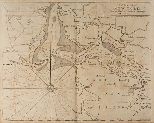
MOUNT and PAGE. The English Pilot. The Fourth Book describing the West-India Navigation, from Hudson's Bay to the River Amazones. 21 engraved mapsheets, plus 4 engraved maps in the text. Folio, contemporary calf, rebacked and retipped; scattered light browning and foxing, offsetting on the maps, free endpaper repaired; early manuscript notes on free endpapers in a single hand listing names of various contemporary sea captains and their ships. London: J. Mount, T. Page, W. Mount, 1780

Additional Details

Maps include: North Part of America from New Found Land to Hudson''s Bay Chart for the West Indies of E. Wright''s Projection Atlantic or Western Ocean Chart of New Foundland, New Scotland, New England, New York, New Jersey with Virginia and Maryland Harbour of Casco Bay Coast of New Foundland South-East Coast of Newfoundland Coast of New England from Staten Island to the Island of Breton Draught of New York from the Hook to New York Town Virgnia, Maryland, Pennsilvania, East & West New Jersey Draught of Virginia from the Capes to York in York River Island of St. Christophers Draught of South Carolina and Georgia from Sewee to St. Estaca Correct Chart of the Caribbee Islands Correct Chart of Hispaniola Draught of the West End of the Island of Porto Rico and the Island of Zachee Chart of Cuba Draught of the Bay of Matanzas Chart of the Island of Jamaica Chart of the Coast of Guayana Chart of the Trading Part of the West Indies. Text maps are: Island of St. Peters Barbados Bermudas Antegua.