Dec 01, 2011 - Sale 2263

Sale 2263 - Lot 194

Price Realized: $ 480
?Final Price Realized includes Buyer’s Premium added to Hammer Price
Estimate: $ 800 - $ 1,200
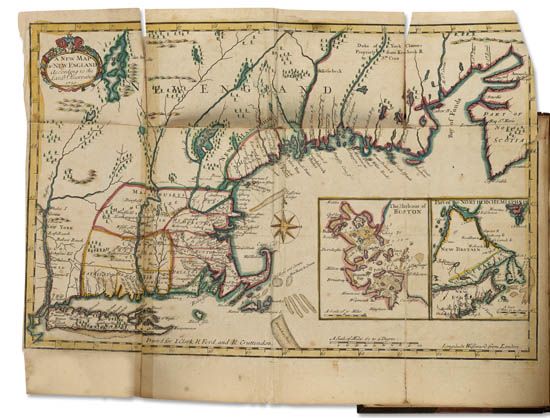
NEAL, DANIEL. The History of New-England Containing an Impartial Account of the Civil and Ecclesiastical Affairs of the Country. Hand-colored folding map, separated at folds with partial cello tape repair. 2 volumes. 8vo, later 1/2 morocco, moderate wear; moderate foxing, minor marginal worming in rear of each volume. London: J. Clark, et al., 1720

Additional Details

Neal used Mather's Magnalia as a starting point, but Larned notes that "he used also contemporary pamphlets and letters, and obtained by inquiry some private information. His work was, therefore, superior to anything of the kind that preceded it. . . . His style is often sprightly and he displays a sense of humor." The map depicts the entire coast from Long Island to the Bay of Fundy, with nice insets of Boston Harbor and Newfoundland. It is believed to be the first map naming New Hampshire (see Krieger, Mapping Boston, page 28). Howes N26 ("aa"); Larned, Literature of American History 991; Sabin 52140.