Dec 09, 2004 - Sale 2027

Sale 2027 - Lot 163

Price Realized: $ 6,900
?Final Price Realized includes Buyer’s Premium added to Hammer Price
Estimate: $ 6,000 - $ 9,000
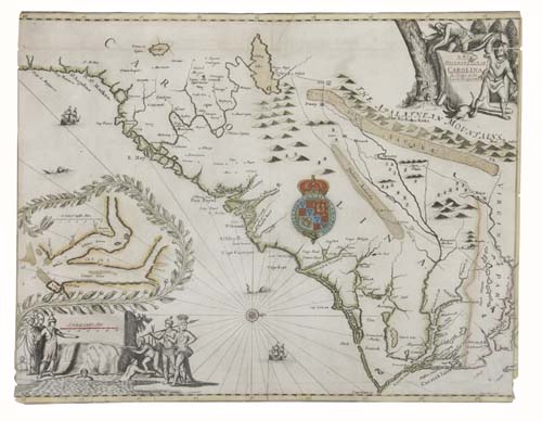
FIRST LORD PROPRIETORS' MAP OGILBY, JOHN; and MOXON, JAMES. A New Description of Carolina. Engraved map, 415x535 mm, margins trimmed all around, to the neatlines on top and bottom, just within the neatline on the right, and to or just within the neatline on the left; hand-colored in outline; 30x5 mm chip along right edge, 100-mm closed tear at bottom of image, repairs on verso along a horizontal crease near the top and another along the bottom. London, circa 1672

Additional Details


This landmark mapping of the region based on information from the Lord Proprietors, Lederer and others is sometimes found in Ogilby's America or in Samuel Wilson's scarce 1682 promotional tract. The map, oriented with North to the East, is one of the earliest mappings devoted to the region and noted as one of the earliest delineations on a printed map of the boundary between Carolina and Virginia. Cumming 70.