Dec 06, 2012 - Sale 2297

Sale 2297 - Lot 94

Price Realized: $ 4,320
?Final Price Realized includes Buyer’s Premium added to Hammer Price
Estimate: $ 5,000 - $ 7,500
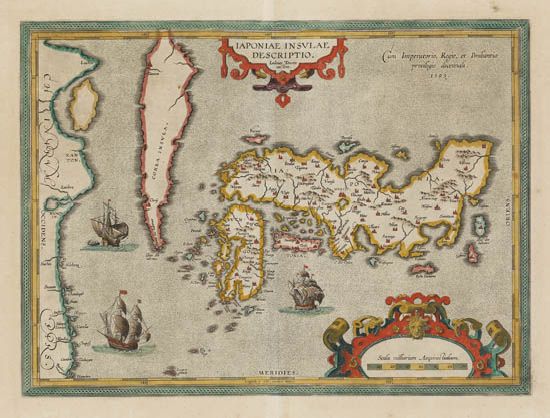
ORTELIUS / TEIXEIRA. Japoniae Insulae Descriptio. Double-page engraved map, 360x485 mm, wide margins, Latin text on verso; hand-colored in outline; very slightly but evenly toned; matted. Antwerp, 1595

Additional Details

"The first printed map of Japan to appear in an atlas . . . this map . . .was to remain the standard form until replaced by the Martini map of 1655" (see lot 71)--Campbell 2. Ortelius received several maps from the Portuguese Jesuit priest, Luis Teixeira, in 1592. Though Teixeira had never been to Asia, let alone Japan, the map is clearly based on local Japanese mappings, as it contains much information not known to European cartographers at the time. Walter 19; Cortazzi, pl. 25.