?Final Price Realized includes Buyer’s Premium added to Hammer Price
Estimate: $ 3,000 - $ 5,000
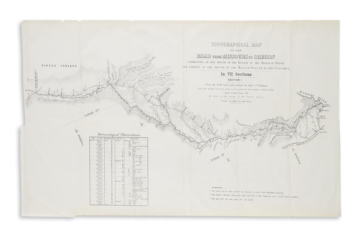
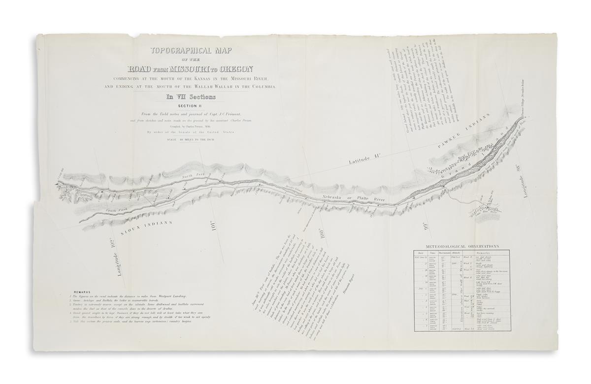
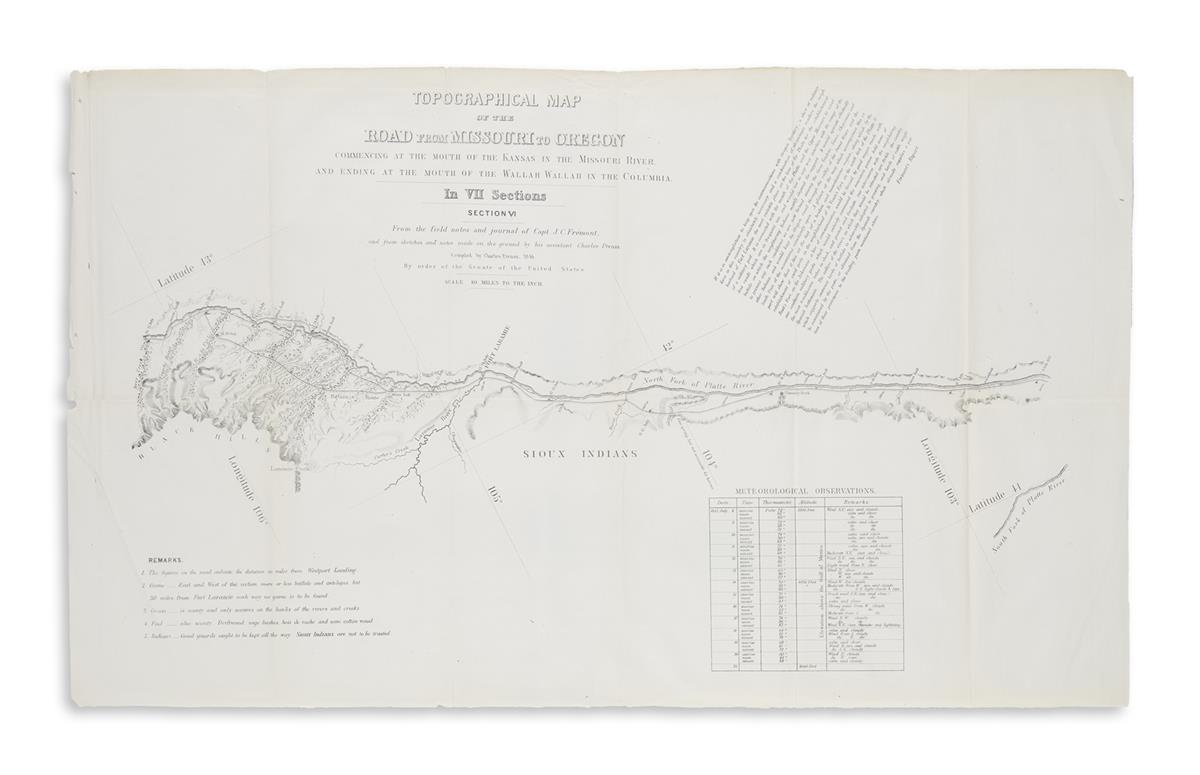
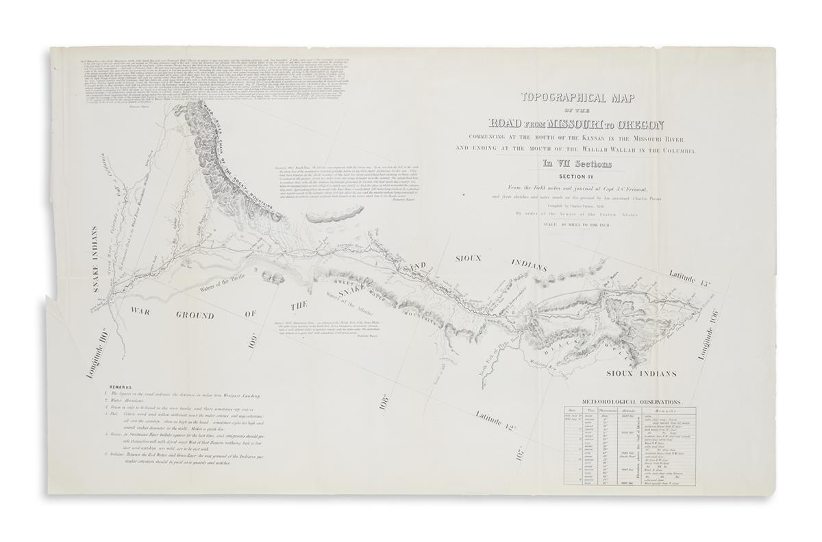
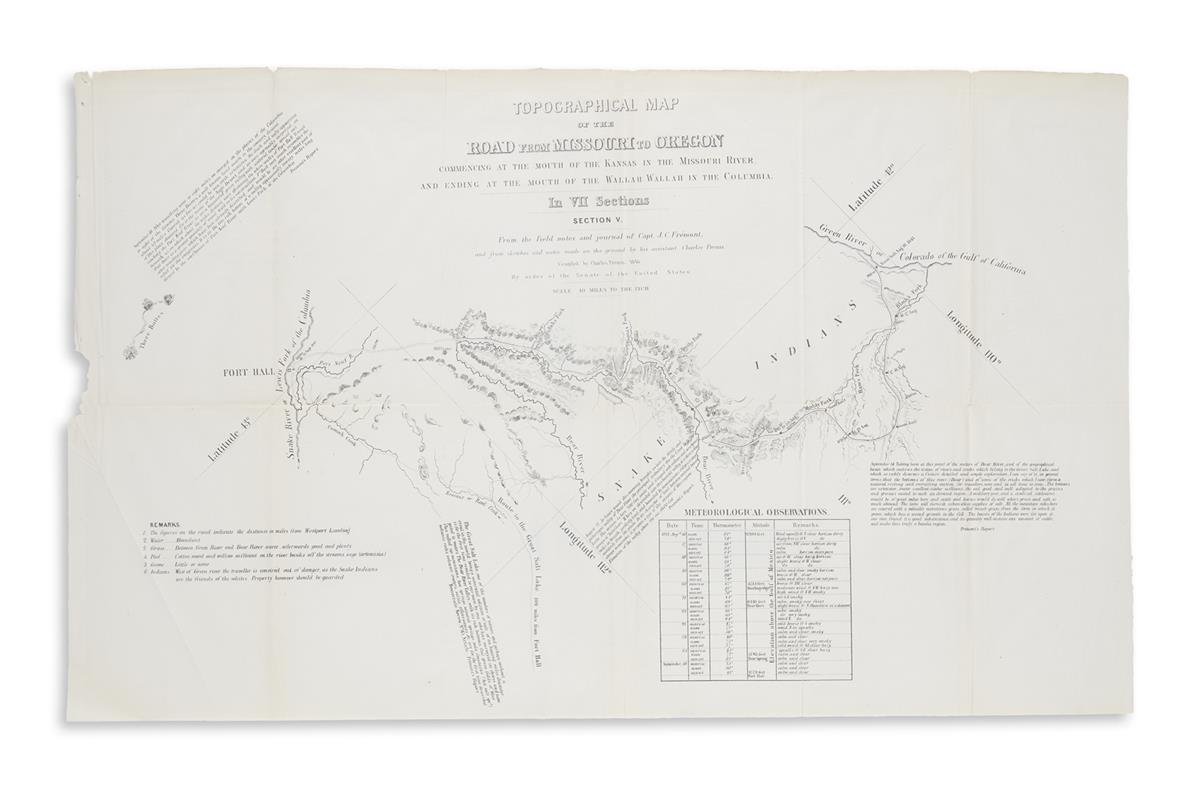
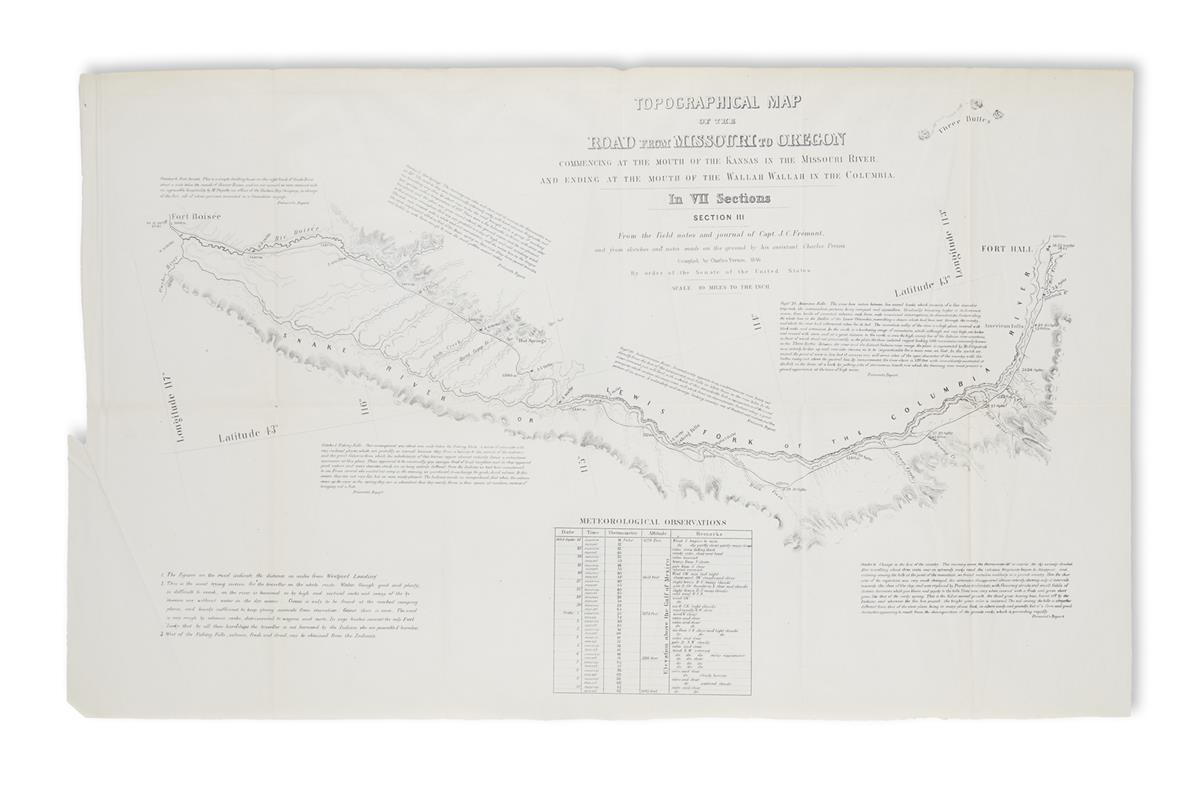
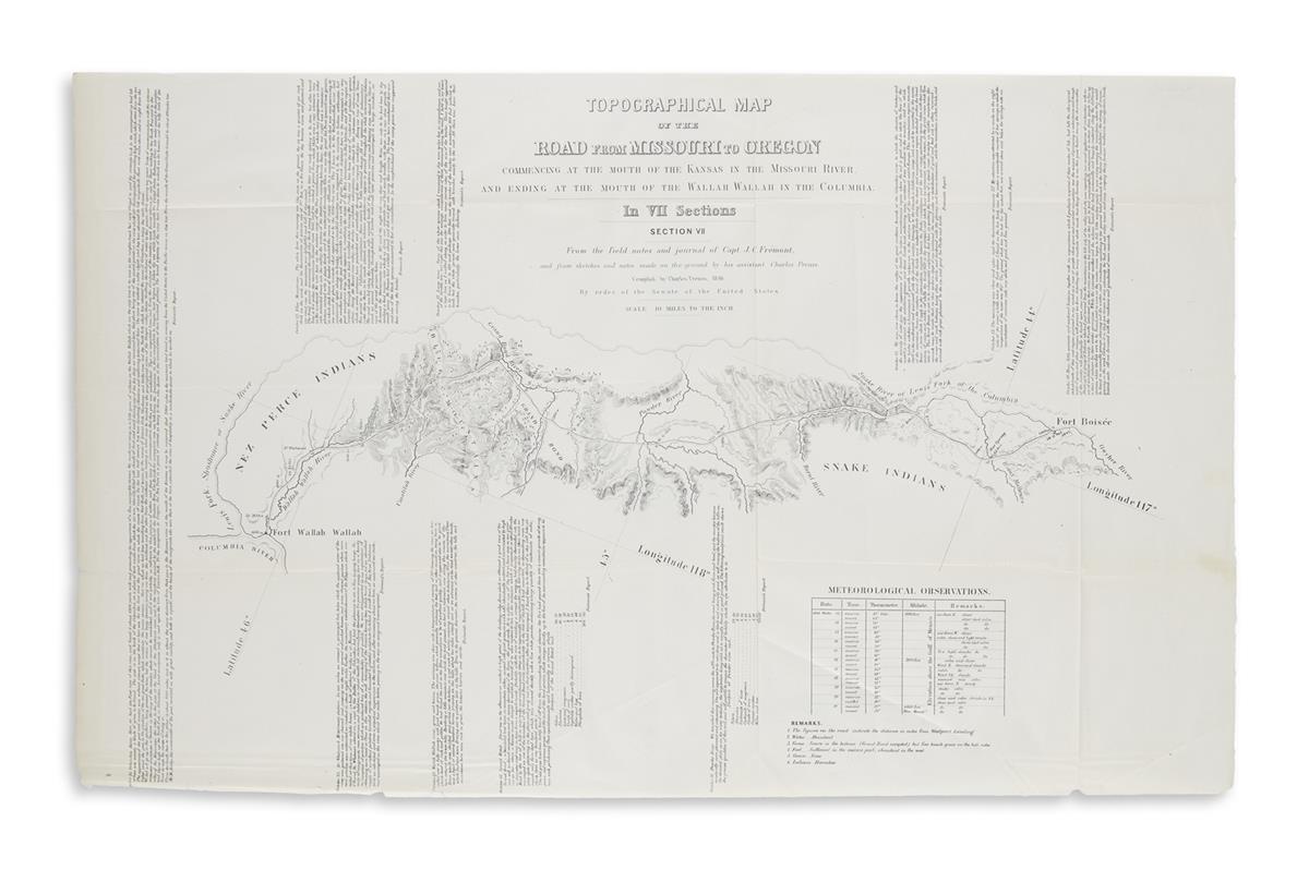
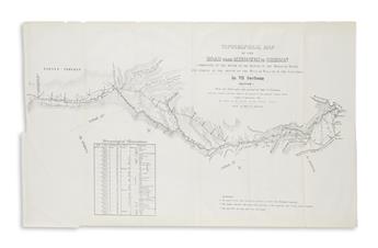
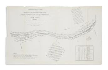
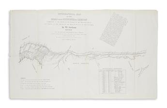
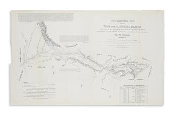
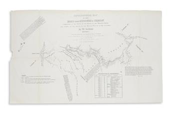
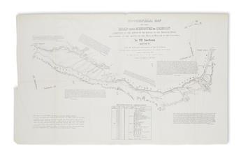
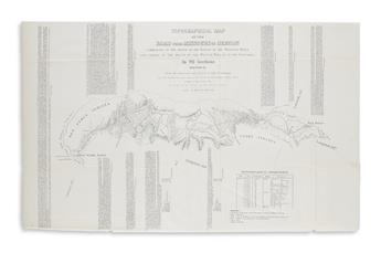
PREUSS, CHARLES. Topographical Map of the Road from Missouri to Oregon.Commencing at the Mouth of the Kansas in the Missouri River, and Ending at the Mouth of the Wallah Wallah in the Columbia. In VII Sections. From the Field Notes and Journal of Capt. J.C. Fremont. Lithographed map on 7 sheets. Approximately 15 1/2x26 inches each sheet size; formerly folded and bound, light offsetting and edge wear but generally very nice; housed in a custom red clamshell box; bookplate of Jay Snider. Washington, D.C., 1846
An attractive example of Preuss's "Oregon Trail Map" in the second state without the lithographer's imprint. "It is a guide for the westward-bound traveler by a mapmaker who had already traveled the route. In fact, most of the information is based on first-hand experience gained on the trail with Fremont. The seven-sheet map with a scale of ten miles to an inch was extremely detailed and practical to use, as a wagon driver could examine it one sheet at a time as he made his way westward" (Cohen). Wheat, TMW 523; Cohen, Mapping the West, pages 136-138.