Dec 08, 2005 - Sale 2060

Sale 2060 - Lot 45

Price Realized: $ 6,325
?Final Price Realized includes Buyer’s Premium added to Hammer Price
Estimate: $ 5,000 - $ 7,500
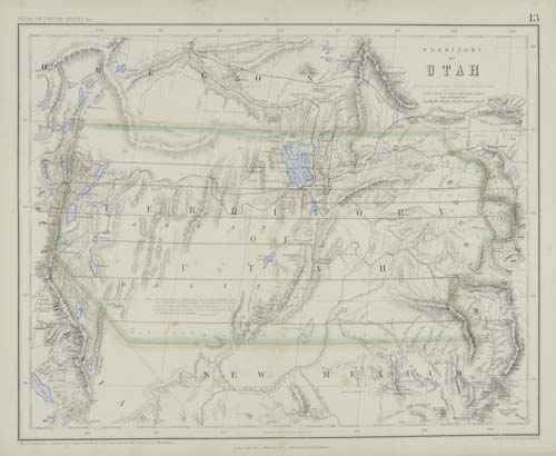
ROGERS, HENRY D., and JOHNSTON, A. KEITH. Atlas of the United States of North America, Canada, New Brunswick, Nova Scotia, Newfoundland, Mexico, Central America, Cuba, and Jamaica. 29 mapsheets, most double-page, most with color in outline, a few with full color. Small folio, 365x250 mm, publisher's 1/2 morocco, extremities scuffed and abraded; scattered foxing. London, (1857)

Additional Details


Rare atlas of the United States - with emphasis on the western States - published in an "unusual collaboration between a Scot (Johnston), an American (Rogers), and an Englishman (Stanford). The maps are all on a scale of 54.5 miles to one inch, and are very well executed. They are derived from the large Map of the United States, British & Central America, by Rogers and Johnston, 1857 (see lot 76 for a later unrecorded edition). The western U.S. maps show the routes of the proposed Pacific Railroad. These maps are perhaps the best examples of highly detailed mapmaking applied to the western territories and states, in the pre civil war period"--Rumsey 3825. 11 of the 14 state maps represent areas west of the Mississippi River. There is an additional map by the same publisher of the city and harbor of Charleston, SC mounted to the front pastedown - probably by the publisher. The map shows Fort Sumter which had been completed just the previous month (map copyrighted 01 February 1861). As Great Britain favored the South in its diplomacy, this additional map may have been an incentive to garner Southern buyers. Phillips Atlases 3670; Wheat 933 and 934 (admiring the maps of California and Utah Territory).