Dec 08, 2005 - Sale 2060

Sale 2060 - Lot 76

Unsold
Estimate: $ 2,000 - $ 3,000
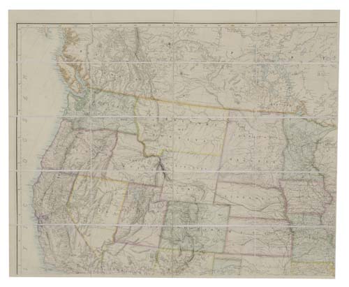
ROGERS, HENRY DARVIN and JOHNSTON, A. KEITH. Map of the United States and Mexico with Canada, New Brunswick, Nova Scotia and Newfoundland, and parts of Central America & the West Indies. Large hand-colored lithographed case map, issued in 4 separate parts, each part consisting of 20 sections, size of entire map with 80 sections is 1760x1400 mm overall; all sections linen-backed; housed in morocco case resembling a book with a top flap, slight wear at extremities of case. London, 1874

Additional Details


The map shows the United States from coast to coast, the whole of Mexico and the southern parts of Canada. It also shows a very strange territorial configuration in the North-West. Idaho Territory is missing its north end so that Montana Territory directly adjoins Washington Territory. Relatively new developments and discoveries are shown - Yellowstone Lake and a "National Park" in the North-West corner of Wyoming, Ogden City and Provo in Utah, Virginia City and an area in its vicinity labeled "Gold" in Montana.
The First Edition of this map was published in 1857 under a somewhat different title (Rumsey 4390) and served as the basis of all the maps that appeared in Roger and Johnston's Atlas of the United States of North America (see lot 45). The only other known editions were issued in 1859 and 1861. The copy here is an unrecorded edition.