Dec 04, 2003 - Sale 1988

Sale 1988 - Lot 390

Price Realized: $ 9,775
?Final Price Realized includes Buyer’s Premium added to Hammer Price
Estimate: $ 2,000 - $ 3,000
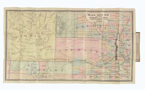
STREETER'S COPY SMITH, D. N.; publisher. New Map. Gold in the Black Hills. Large hand-colored engraved folding map (450x780 mm) depicting the region from Council Bluffs, Iowa as far west as Salt Wells, Wyoming. The accompanying text, 40 pages, railroad ad tipped to the rear endpaper. 8vo, publisher's cloth, nicely rebacked and recased; foxing to the front free endpaper and title, tear to the map where mounted to the covers; inscribed by Smith in pencil on the front free endpaper; Thomas W. Streeter's booklabel on the rear pastedown. Burlington, Iowa, 1876

Additional Details


"The publication of this pamphlet and map in March, 1876, came at a time when, because of the huge price demanded by the Sioux Indians in the fall of 1875 for a cession of their lands, the government had lifted its embargo on settlement of the Black Hills. The pamphlet’s extracts from the 1874 reports by General Custer and Captain Ludlow, the extracts from the mining laws, and especially the map, must have been most useful to many of the thousands who swarmed into the Black Hills in 1876"--Streeter Sale 2060 (this copy); Graff 3837; Howes S585; Wheat, Mapping the Transmississippi West 1277.