Dec 08, 2005 - Sale 2060

Sale 2060 - Lot 81

Price Realized: $ 1,955
?Final Price Realized includes Buyer’s Premium added to Hammer Price
Estimate: $ 1,500 - $ 2,500
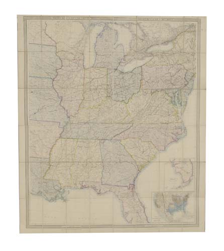
STANFORD, EDWARD. Stanford's Map of the Seat of War in America. Large hand-colored lithographed case map in 48 sections, 1270x1050 mm overall; linen-backed; lacking the original case. WITH--North-East quarter of the above mentioned map in 24 sections, 710x595 mm overall; linen-backed; folding into the original small 8vo format cloth case, case with original paper title label on cover. Both maps housed in a modern morocco folding box. London, 01 October 1861

Additional Details


The map shows the United States from New York City on the east end to the western parts of Louisiana, Arkansas, Missouri, Iowa on the west end. On the north the map shows the area to Montreal in Canada on the east end and the southern parts of Minnesota on the west end. The Gulf Coast and the mouth of the Mississippi are covered on the south and the southern part of Florida is shown in an inset map (205 mm x 190 mm) placed in the Atlantic. Railroads are shown by a large number of red lines throughout the country. A large inset map (265 mm x 190 mm) in the bottom-right corner of the map shows the whole United States, from coast to coast, and is colored in full by State. The inset map is very up to date showing Colorado, created as a Territory just 7 months prior to the publication of this map. A large Nebraska is shown covering the area of present day Wyoming and Montana, Arizona is south of New Mexico, Nevada's border with California runs along the Sierra Nevada mountain range and the Territory has no southern tip which is still a part of New Mexico. Oregon and Washington occupy present day Idaho.
This map was also sold as 4 separate smaller area maps, each in its own case with a wide border and the North-East sheet included is an example. These area maps were sectioned in smaller parts than the large map. Not in Rumsey.